12 Amazing National Parks Perfect for Family Adventures
Across the USA, there are approximately 63 parks classified as national parks, meaning they are federally designated (as opposed to state parks or national monuments). These parks are the crown jewels of the breathtaking American nature and an essential part of any trip in this vast country. America boasts some of the world's most unique natural sites in a wide range of climate zones and topographical expanses. The parks are a great destination for a family trip in the USA, with excellent facilities, high development standards, and plenty of options for entertainment or learning for children of all ages.

Here are, in our opinion, the 12 best national parks in the USA for a family trip:
- Yosemite – Stunning nature not far from San Francisco
- Yellowstone – A unique volcanic area
- Everglades – Swamp tours near Miami
- Death Valley – Extreme desert scenery near Las Vegas
- Rocky Mountain – Magical snowy peaks above Denver
- Crater Lake – A volcanic crater in southern Oregon
- Joshua Tree – Surreal desert and stargazing not far from Los Angeles
- Bryce Canyon – Unique hoodoo formations in Utah's desert
- Arches – Dozens of natural arches near Moab, Utah
- Acadia – The rugged nature of Maine
- Grand Canyon – Stunning views from the edge of the abyss in Northern Arizona
- Zion – Enchanting streams and canyons in the breathtaking nature of Southern Utah
The national parks in the USA are mostly located in the western part of the country, in the Rocky Mountains (Yellowstone, Grand Teton, etc.) and the Colorado River Basin (Grand Canyon, Zion, Bryce Canyon, and more).
There are legendary parks in the Sierra Nevada mountain range in California, with Yosemite at the forefront, in the Appalachian range in the east, in the unique natural expanses of Florida, in the tropical nature of Hawaii, and in many other areas, some of which are remote, including the giant parks of Alaska.
The variety of national parks in the USA includes an incredible spectrum from alpine mountain nature with snow (even in summer) and glaciers, to parks of eroded desert nature, wild beaches, swampy areas, karstic caves, volcanic regions, and more.
In the parks selected for the list, we checked and examined the following parameters to help you choose your travel destination in the USA:
- We checked the proximity and access to the park from nearby airports
- We checked whether the lodging options are comfortable for families with children
- We evaluated the quality of the national park's facilities
- We checked whether there are unique attractions for children in the park
- We assessed if it is convenient to drive through the park with a car
- We checked the hiking options in the park with kids (without taking on long trails)
- We assessed whether there are enough shops, restaurants, and the like nearby
1. Yosemite
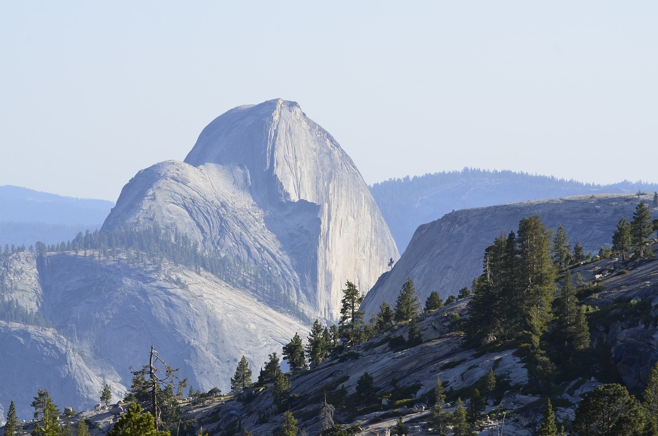
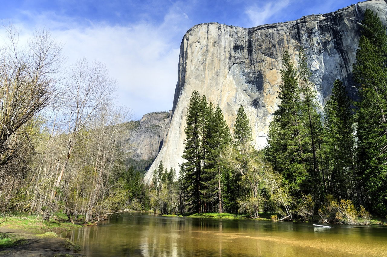
Yosemite National Park is one of the most popular natural areas in the USA. It's a must-visit spot for nature-loving families traveling to California, and some consider it a highlight of a West Coast trip. Just a three-hour drive from San Francisco lies the breathtaking Yosemite Valley, featuring iconic peaks like El Capitan and Half Dome, a series of well-known tall waterfalls along the Merced River and its mountain tributaries, unique monolith dome peaks, and a crowd of tourists who flock to its enchanting valleys every summer. Yosemite Park is famous for the geological structure of the glacial valley and its legendary hiking trails.
Click here for all the information on touring Yosemite National Park…
How to get to Yosemite National Park in California?
Fresno-Yosemite International Airport (FAT) is roughly a two-hour drive away.
San Francisco International Airport (SFO) is about a three-hour drive away.
Click here for a round trip bus journey from San Francisco to Yosemite…
What is Yosemite National Park?
Yosemite Park is one of the most popular parks for nature trips in the USA. The park is located in the eastern part of California, on the slopes and peaks of the Sierra Nevada mountain range. The park lies in the higher part of the Sierra Nevada range, with the peaks towering above the canyons and valleys reaching up to 4,000 meters. The heart of the national park is the Yosemite Valley, where the Merced River rapidly descends until it flows into the San Joaquin River in the San Joaquin Valley, part of California's Central Valley.
Beyond the park's stunning geological landscape formations, it is considered a very important ecological area with over 160 rare plants and a large variety of wildlife. Due to the park's topographical structure, it is divided into climatic sections ranging from peaks at 4,000 meters down to slopes at 600 meters. These sections include five distinct climatic zones adjacent to each other, creating a unique zoological and botanical richness.
- The park spans a sequence of mountainous plains and canyons formed by the erosion of rock due to glacial retreat. These valleys are referred to as U-shaped valleys, with the most famous in the park being Yosemite Valley along the Merced River.
- The rock of the park is predominantly granite, and due to erosion, there are stunning geological formations within the park that have become iconic in the Sierra Nevada.
- The park features a series of magnificent granite domes created from monoliths (gigantic singular rocks).
- The most recognized mountain in the park is El Capitan, paradise for alpine climbers and one of the toughest and most attractive climbing destinations in the world.
- Among the valleys and peaks are countless breathtaking waterfalls, many of which are located in the Yosemite Valley section.
- Among the park's icons are the giant sequoia trees, which can also be seen in Sequoia Park to the south, and especially in King's Canyon Park.
Click here for a list of 8 comfortable lodge hotels near Yosemite National Park…
2. Yellowstone
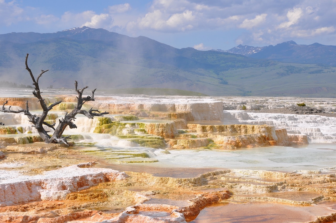
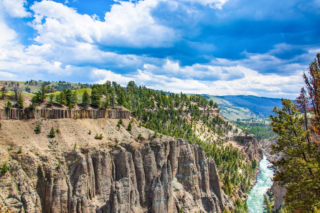
Yellowstone National Park is the cradle of the world of nature conservation. It is the first national park established in the world, aiming to preserve the unique nature of northwestern Wyoming. The park is an active volcanic area with breathtaking geysers and geothermal springs. Besides the volcanic expanse, the park is a rugged wild nature filled with bison, moose, elk, and occasionally grizzly bears. Throughout the park, there are hundreds of kilometers of hiking trails of varying difficulty, along mountain stream channels, near lakes, on peaks, and at the brink of the majestic Grand Canyon of Yellowstone.
Click here for all the info on exploring Yellowstone National Park…
How do you get to Yellowstone National Park in Wyoming?
Yellowstone Regional Airport (COD) in Cody – A one hour and forty-five-minute drive to the park's east entrance via Highway 14.
Jackson Hole Airport (JAC) – Located near Highway 89, connecting the town of Jackson with Grand Teton National Park. Technically, this airport is within the national park's boundary, making it the only commercial airport in the world located inside a national preserve. The airport operates year-round.
Yellowstone Airport (WYS) in West Yellowstone – A regional airfield about a half-hour drive from the park's east entrance.
How to explore Yellowstone Park?
The trip through Yellowstone Park is by car, driving between clusters of sites and attractions. It's a very organized park with vehicle access to almost all the main attractions. Near the attractions, there is a large parking lot from which hiking trails begin. The park boasts dozens of marked trails of varying difficulty, so it's advisable to plan the trails you want to hike beforehand.
What is Yellowstone National Park?
Yellowstone National Park is a stunningly beautiful space that combines wild nature, complex geological forms, an active volcanic area, a vast array of wildlife, botany, and all the fun of American mountainous nature.
The park is located at the center of a mega caldera, the heart of which is Yellowstone Lake. This giant caldera is not a single volcano but a sequence of volcanic ridges whose eruption could impact the entire world. The park is a hotspot on the North American tectonic plate (in the middle of the plate, not on the border like the San Andreas Fault in California), with intense seismic activity and geothermal features including large geyser basins, sulfur lakes, and other volcanic eruption features.
- Yellowstone National Park was established on March 1, 1872
- Upon its declaration as a national park, it became officially the first nature reserve in the world. The park covers an area of almost 9,000 square kilometers (nearly half the size of New Jersey), most of which is pristine nature that travelers' feet have yet to tread.
- Each year, more than three million visitors come to Yellowstone (in fact, in just half a year), and as summer approaches, the number of visitors to the park intensifies.
- Most visitors to Yellowstone also visit the Grand Teton National Park to the south
- During the summer months, the park can become almost unbearably crowded, with traffic jams and a real challenge finding accommodation within a reasonable distance from the park
Click here for a list of 10 lodges and motels near Yellowstone National Park…
3. The Everglades
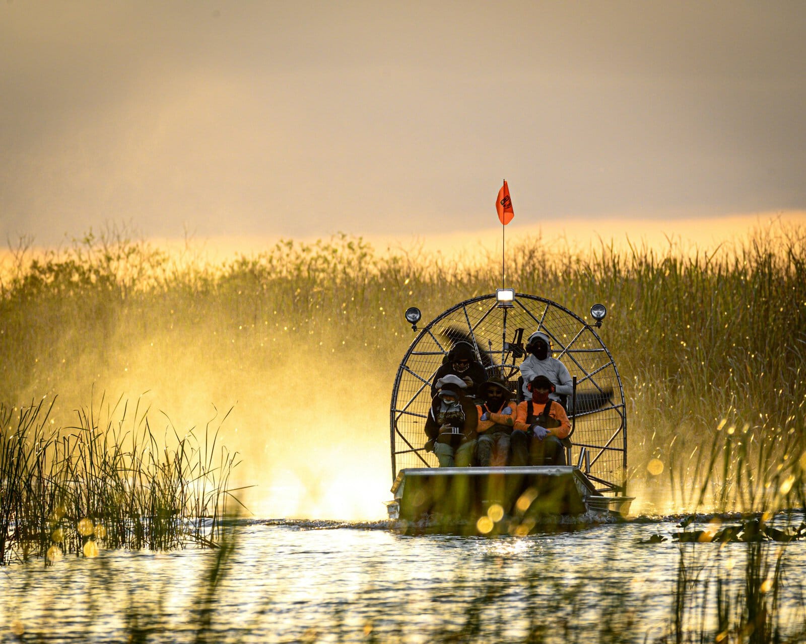
The vast and famous nature reserve of Florida, located south of Miami, covering a huge area that spans the entire tip of the state. It's a massive region of swamps and unique wildlife. It's teeming with alligators swimming in thousands of ponds, lakes, and marshes of the area. Almost all park areas are inaccessible to humans and in terms of size, it is the third largest park in the entire USA.
The only road through the reserve is the Main Park Road, which leads all the way to Flamingo, a large research and camping site at the state's edge. From Flamingo, you can set off on motorboat cruises through the swamps and lakes to witness the magnificent nature of Florida.
Click here for a half-day trip to the Everglades (departing from Miami)…
How to get to Everglades National Park in Florida?
Miami International Airport (MIA) – a one and a half-hour drive from Flamingo.
Death Valley
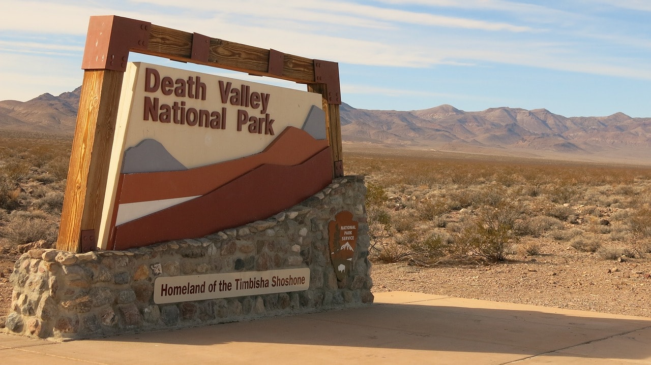
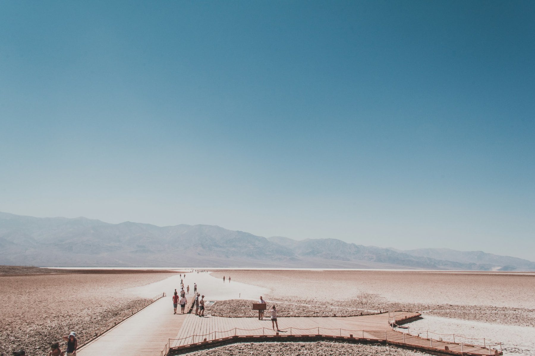
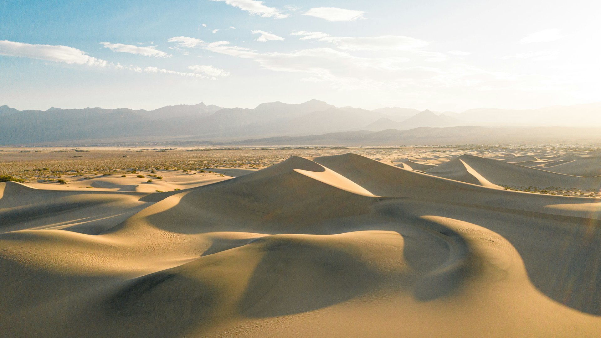
Death Valley National Park is one of the most unique parks for a trip in the entire United States. The park is situated just beyond the border of Nevada within eastern California, about a two-hour drive from Las Vegas. It is an extreme rain shadow desert and is considered the hottest place on earth. It’s also the lowest point in the Western Hemisphere. In Death Valley, you can find unique trails on the salt flats of a lake that dried up under the scorching sun, paths climbing desert canyons, special geological formations, and an extreme desert atmosphere.
Click here for all the information about a trip to Death Valley National Park…
How to get to Death Valley National Park in California?
Harry Reid International Airport (LAS) in Las Vegas – a two-hour drive from the park.
How to explore Death Valley in California?
The trip to Death Valley is from October to April. From May to September, the temperatures in the valley are extremely hot, and travel is possible only in an air-conditioned vehicle with short stops (hat and sunglasses are mandatory at the viewpoints). The center of the trip in Death Valley is the Furnace Creek Visitor Center (just an illustration of the Furnace Creek), from where the Badwater Road leads south, along which the main attractions of the National Park are located.
In this area, the trip is divided between hiking trails leading to points in the Amargosa Range and walking in dry stream channels, and climbing onto the salt flats of the dried-up lake. There are also a few points of interest just north of the visitor center, including the dunes and hiking trails up the channels, plus unique attractions in the northern part of the valley, most of which are easily accessible by car.
What is Death Valley National Park in California?
Death Valley is one of the most extreme and famous national parks in the USA. The national park is located in the eastern part of California, just beyond the border with Nevada. The closest major city to the park is Las Vegas, just a two-hour drive from the heart of the park – Death Valley.
Death Valley is situated in the northern part of the Mojave Desert, at the intersection with what is known as the Great Basin Desert, covering all of Nevada. The massive rain shadow desert is not far from the eastern slopes of the Sierra Nevada mountain range, which block cloud movement and create the dry rain shadow desert. The valleys were once (millions of years ago) drainage basins of lakes that dried up, and these are the source of the salt layers on the ground.
The national park boasts several significant records:
- The valleys of the park are located below sea level. Badwater Basin is the lowest point in the USA and all of North America, at 86 meters below sea level. Mount Whitney, the highest point in the USA (excluding Alaska), is just 130 kilometers west of the park.
- This is the hottest place in the world (in the summer, it's quite pleasant in the winter), and it holds the record for the highest temperature ever recorded on Earth (nearly 57 degrees Celsius in 1913).
- It is the driest place in North America (and the second driest in the Americas and the world) with a ridiculously low average yearly rainfall of 16 mm.
- It is the largest national park by area in the continental USA (excluding Alaska).
5. Rocky Mountain
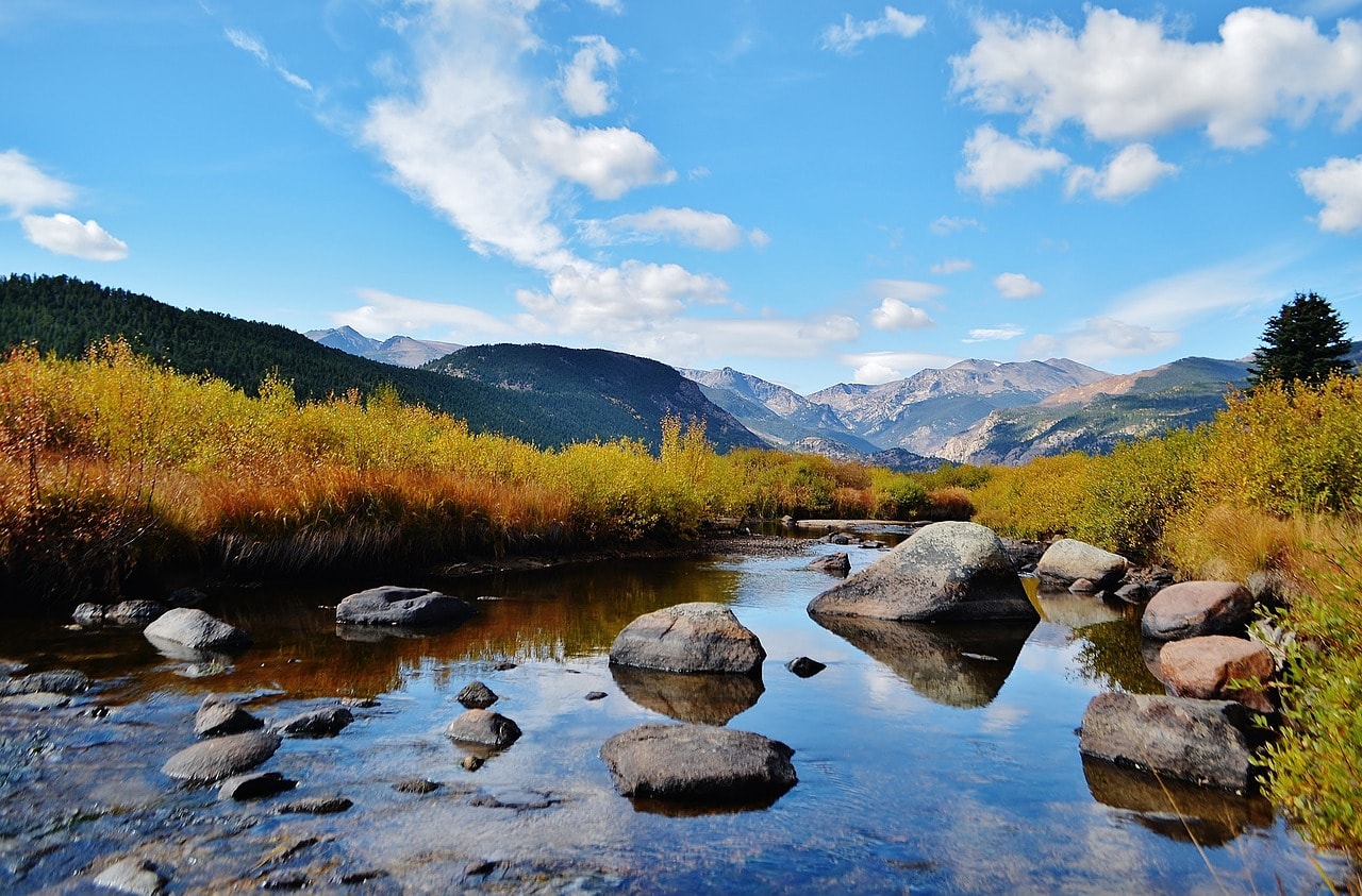
Rocky Mountain National Park is one of the most visited parks in the world. Not far from the major city of Denver, the capital of Colorado, lies the rugged natural area of the Front Range – one of the ranges that make up the Rockies, with peaks soaring over 4,000 meters. This high area was conquered early in the 20th century with the opening of Highway 34 or Ridge Trail Road, which crosses the range towards the Colorado River gorge.
Estes Park is the base for exploring the park. This small town, sitting at an elevation of 2,300 meters, turns into a bustling city in the summer with a plethora of hotels, restaurants, and entertainment spots. Nearby are stunning natural sites, enchanting alpine lakes, hiking trails of varying levels, and all the fun of the American outdoors.
Click here for all the information about traveling in Rocky Mountain National Park in Colorado…
How do you get to Rocky Mountain National Park in Colorado?
Denver International Airport (DEN) – less than an hour and a half drive from Estes Park.
How to explore Rocky Mountain National Park?
Exploring the Rocky Mountain National Park is one of the most organized and convenient experiences among the national parks along this vast range. Estes Park is a large and lively town where you can buy food, find accommodation, and even enjoy evening activities. The town is conveniently located near the main attractions of the park, making it easy to access the entire rugged natural area by car or on foot.
For those eager to go hiking, there's a wide range of trails, from climbing Longs Peak, which is for professionals only, to scenic loop trails around beautiful small lakes accessible by car. The most picturesque section of the park can be accessed by driving along the Ridge Trail Road, which crosses the Continental Divide and descends toward the Colorado River on the western slopes.
It's highly recommended to find accommodations in Estes Park as a base for exploring the national park
Click here for a list of 8 outstanding rural hotels and motels in Estes Park…

What is the Rocky Mountain National Park?
Rocky Mountain National Park is a breathtaking section of the giant range, at the peaks of the Front Range subrange. The western slopes of the range in the park are the source of the massive Colorado River. It is the first among the series of legendary national parks along the Colorado River flowing southeast through the parks of southeastern Utah and northern Arizona.
- The park's logistic center is the town of Estes Park, with a permanent population of 6,000 people. Estes Park is located in the eastern part of the park towards Denver, the capital and central city of Colorado, on the bank of the small alpine Lake Estes.
- Estes Park is connected by the mountainous Trail Ridge Road (Highway 34) to the park's western entrance gate, the small town of Granby, where about 2,000 residents live permanently.
Rocky Mountain National Park is considered one of the five most popular parks in the United States, with nearly five million visitors a year. It stretches at an elevation of 2400 meters above sea level, and its pinnacle is Longs Peak, standing at 4350 meters tall.
6. Crater Lake
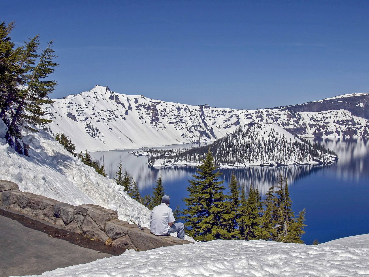
Crater Lake National Park is one of the most remote and beautiful in the temperate parts of the USA. The park is more than a four-hour drive from Portland, Oregon, located in the southern part of the state. The park is centered around an alpine lake with exceptionally clear waters. The lake's waters are collected in an ancient caldera (or volcanic crater, to be precise) in the geologically active Cascade Range. The lake's waters rest nearly 300 meters above the abyss, or the caldera's rim, creating an extraordinarily beautiful landscape view. Above the abyss runs Rim Road, one of the most popular scenic drives in the USA.
Click here for all the information on visiting Crater Lake National Park…
How do you get to Crater Lake National Park in Oregon?
Rogue Valley International–Medford Airport (MFR) – About a one and a quarter hour drive from the park.
Portland International Airport (PDX) – About a four-hour drive from the park.

How to explore Crater Lake?
Crater Lake is a small national park by American standards, offering various ways to explore it. The most convenient way is driving on Rim Road, a scenic route that runs along the edge, with well-marked lookout points and parking. The road leads to several hiking trails, some of which are challenging and include climbing. There's also a trail leading down to the boat dock for those interested in a boat ride on the lake. Just keep in mind that the descent to the dock is somewhat challenging (the climb back even more so).
What is Crater Lake National Park in Oregon?
Crater Lake, or the caldera lake, is a clear and stunning lake in the southern part of Oregon. The lake fills a dormant volcanic caldera that is nearly 600 meters deep. The caldera erupted 7,000 years ago and has since filled with lake water mostly from rain over thousands of years. As there are no rivers that flow into or out of the lake, all the water is sourced from precipitation, resulting in the lake’s incredible clarity. The clarity is also due to the frigid temperatures, which prevent the proliferation of microbes. The lake covers an area of 53 square kilometers with a coastline of 35 kilometers. In line with the appearance of a caldera, the lake is round and measures eight kilometers in diameter.
- The water level of the lake is 1,800 meters above sea level, approximately three hundred meters on average below the caldera rim.
- On the western side of the lake is Wizard Island, formed from a subsequent volcanic eruption. It is the tip of a lava tube cone created about 6,000 years ago. The cone rises about two hundred and fifty meters above the lake's surface. Wizard Island is accessible by boat and is one of the main attractions when visiting the national park.
- Adjacent to Wizard Island are a few small islets that are part of the cone and emerge with the lake's rising water levels during high tide.
- On the southern part of the lake, there's another islet called Phantom Ship, named because it resembles a ghost ship peeking through the mists of the lake.
7. Joshua Tree
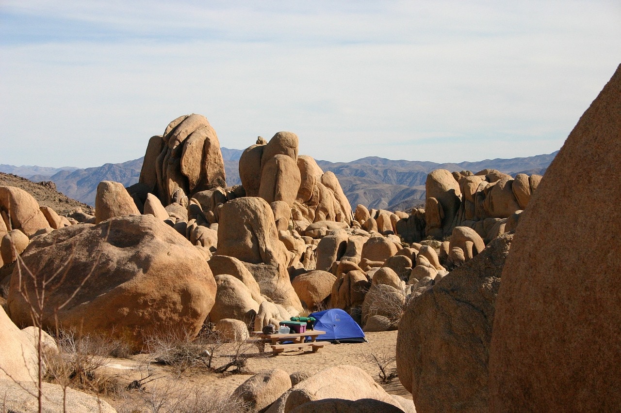
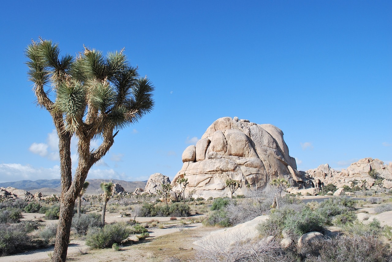
Joshua Tree National Park offers a stunning desert nature experience just a short drive from Los Angeles. It's one of the most popular national parks in the United States, mainly due to its proximity to the popular resort town of Palm Springs, nestled down the ridge in Coachella Valley. The park is set on an elevated plateau at an average height of one kilometer in a rain shadow desert. It's characterized by its breathtaking geological rock formations filled with peculiar boulders and magnificent desert vegetation, mainly the unique Joshua Trees and various endemic cacti species.
Click here for all the information about a trip to Joshua Tree National Park…
How to get to Joshua Tree National Park in California?
Palm Springs International Airport (PSP) – a forty-minute drive from the park entrance.
Los Angeles International Airport (LAX) – a two and a half hour drive from the park.
How to explore Joshua Tree National Park?
Joshua Tree National Park is a vast natural area of hilly plateau, some accessible by car and some by trails. Most visitors drive along Park Boulevard and Pinto Basin Road. These roads cross the hilly plateau and are close to the park’s main natural attractions. There are also dead-end roads leading to park attractions, mainly west towards cliff edges.
The park area is an open space where you can hike on a variety of unofficial trails. These trails are very popular among rock climbers and rappelling enthusiasts. The barren landscape is also one of the most popular places in the western United States for stargazing at night. During meteor showers, the park is flooded with campers and stargazers. Due to its clean atmosphere, the star viewing is simply breathtaking.
What is Joshua Tree National Park?
Joshua Tree National Park (unlike the legendary U2 album that bears its name) could be considered the national park of the greater Los Angeles area. It's situated on the eastern outskirts of the metropolis on a plateau ranging from 900 to 1200 meters high at the eastern end of the valley. The park is located above the city of Palm Springs, about an hour and a quarter drive from San Bernardino and two and a half hours from downtown Los Angeles.
- The park is part of a rain shadow desert on the western slopes of the Little San Bernardino Mountains above Palm Springs. It's the boundary between two deserts – the higher plateau to the west is part of the Mojave Desert, and the lower plateau in the east of the park, which is about 900 meters high, is part of the Sonoran Desert.
- It is named after the large concentration of Joshua trees in its area, a yucca-like shrub that resembles a tree. The Joshua tree is endemic to the Mojave Desert and is one of the most distinctive icons of the desert regions south of the Rockies. In the park's area, you can see many Joshua trees in varying concentrations.
- The desert area is also characterized by significant geological erosion of the rocks, which creates many breakages of rocks and huge boulders. The scattered boulders have become one of the most popular destinations in the world for rappelling and mountain climbing.
Click here for a list of 10 hotels and resorts in Palm Springs and near the park…
8. Bryce Canyon
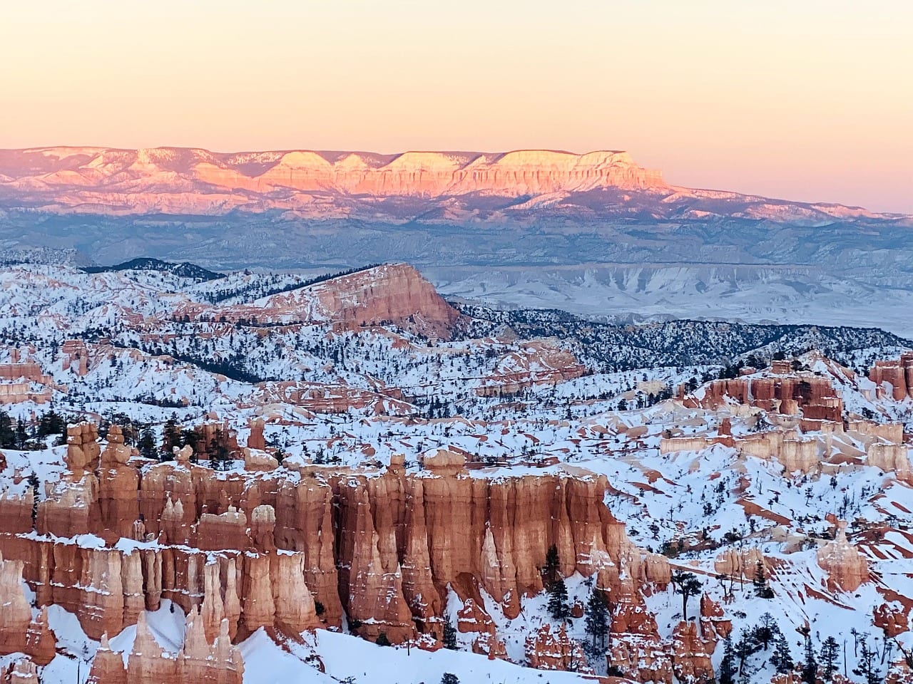
Bryce Canyon National Park in southern Utah is one of the most unique geological spaces in the United States. In the broad canyons formed by the erosion of the soft sandstone, unique Hoodoo structures, which are the park's hallmark, can be found. These rock columns, also known as Fairy Chimney or Earth Pyramids, fill the entire eastern fault line of the amphitheater-shaped canyons. Above the chasm is the popular Rim Trail that stretches between viewing points. Above the abyss is a long road that connects the 13 viewing points of the park.
Click here for all the information on traveling to Bryce Canyon National Park…
How to get to Bryce Canyon National Park in Utah?
Harry Reid International Airport in Las Vegas (LAS) – a three and a half hour drive from the park.
Salt Lake City International Airport (SLC) – a four hour drive from the park.

How to Explore Bryce Canyon National Park?
Traveling through Bryce Canyon is relatively straightforward. The journey includes driving along Bryce Canyon Road (Highway 63) from Bryce Canyon City in the north to Rainbow Point overlook in the south. The road runs along the rim, providing access to 13 different lookout points along the ridge above the cliff.
Hiking trails connect the viewpoints, with the most notable being the Rim Trail, which is considered easy with no steep inclines or declines. Several excellent hiking trails descend from the rim in various levels of difficulty (from medium to hard) and lead to some of the canyon's unique landscape features. A more exhilarating way to explore the trails down the canyon is by horseback riding.
What is Bryce Canyon National Park?
Bryce Canyon National Park is one of the most unique landscapes in the United States. It's the second most popular park in the legendary collection of parks in the southern part of Utah, since the popular Zion National Park is located an hour and a half drive westward.
Click here for a horseback tour in Bryce Canyon…
- The park is situated on the western part of the Paunsaugunt Plateau, a geological segment in what is known as the Colorado Plateau
- The western edge of the plateau is characterized by sedimentary and sand rocks from different periods that are layered and exposed from the canyon's formation
- Bryce Canyon was formed by what is called backsplash erosion. It is a geological formation created by the flow of mountain streams descending in a waterfall from the cliff heights. At the bottom of the cliffs, the lower watershed waters dig and bite into the rock from which the waterfall descends, leading to the creation of a geological formation resembling an amphitheater structure.
- The erosion of water and wind on the layers of sedimentary and sandstone created a unique sculpture of stunningly beautiful rock columns along the entire semicircle of the amphitheater. These sculpted columns are called Hoodoo.
- The largest of the semicircles in the western rock line of the plateau is the Bryce Amphitheater, which is almost 20 kilometers long and about 200 meters high.
The base for a trip to Bryce Canyon is Bryce Canyon City, which serves as the logistic and hotel center of this rare natural area.
9. Arches
Arches National Park is one of the most beautiful and unique national parks in the Colorado River Plateau. Located on the western slopes of the Rocky Mountains, near the town of Moab in Utah at the starting point of the Great Rain Shadow Desert, this park is characterized by stunning geological arches.
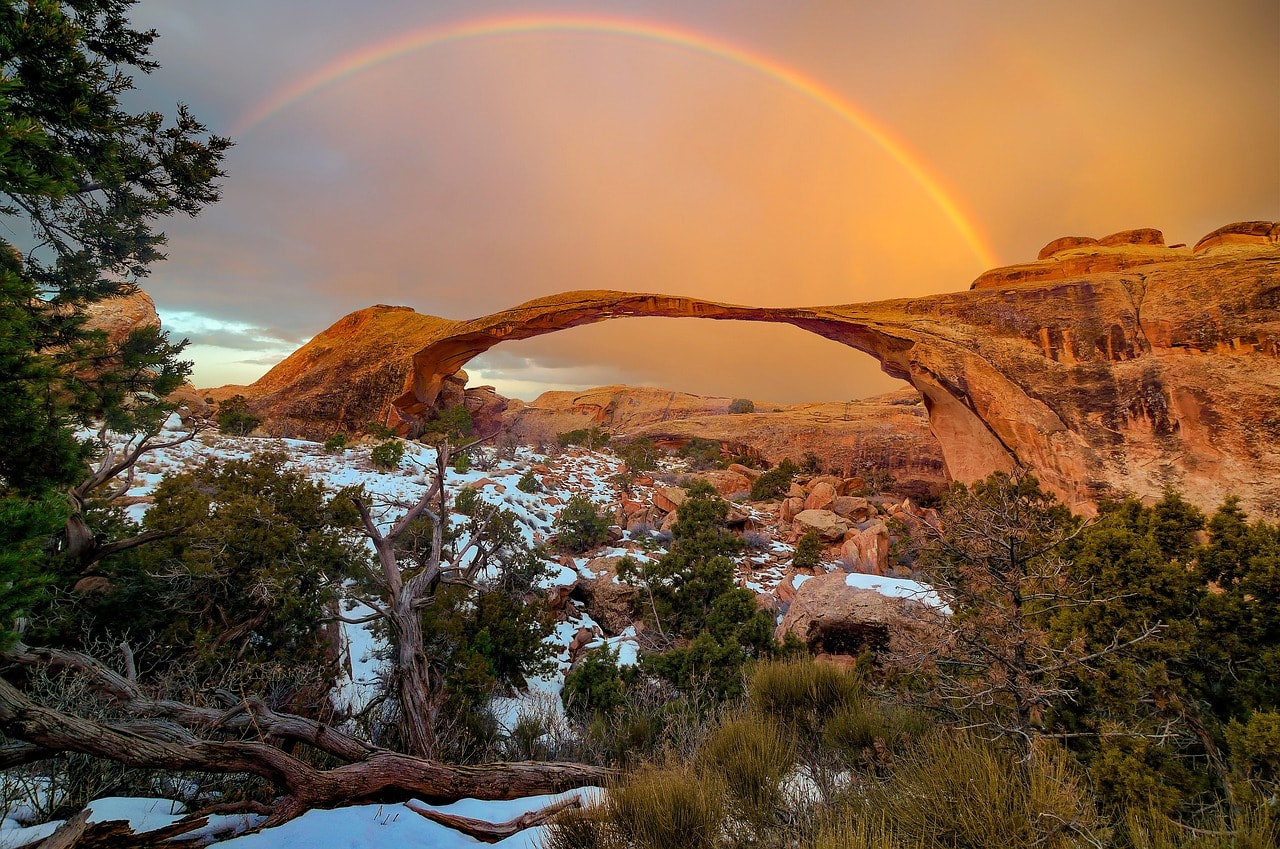
The park hosts more than 2,000 arches, some of which have become famous attractions, including the widest arch in the world. Besides the arches, the national park offers hiking trails bustling with visitors, breathtaking viewpoints towards the Rocky Mountains, and surreal sites and attractions near mesa mountains, hoodoo structures, and striking rock columns.
Click here for all the information on visiting Arches National Park…
How do you get to Arches National Park in Utah?
Canyonlands Regional Airport (CNY) – a fifteen-minute drive from the park.
Salt Lake City International Airport (SLC) – a three-and-a-half-hour drive from the park.
Click here for a light aircraft flight + guided tour over Arches and Canyonlands National Parks…
How to Explore Arches National Park?
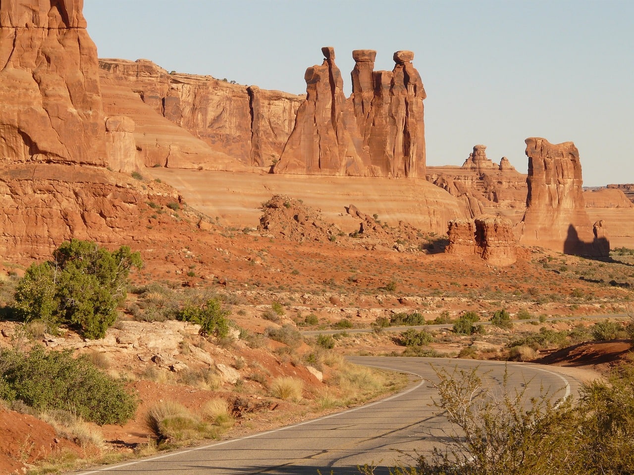
Exploring Arches National Park involves driving and making stops at various viewpoints near the stunning arches, buttes, and mesas. At these stops, you can find trailheads that lead you to attractions. The park has a limited number of hiking trails, most of which are very popular and some quite challenging, so it's important to know the trail's nature before starting. The trails are especially inviting in the autumn and spring. During summer and winter, the main journey is in the comfort of an air-conditioned vehicle since the weather often isn’t suitable for long outdoor hikes.
What is Arches National Park?
Arches National Park, known for its stunning geology, features a breathtaking array of natural stone arches, considered the largest concentration of natural arches in the world.
- In the park, there are over 2000 stone arches of various sizes, some of which have become its main attraction. The most famous among them include the world's longest natural arch – the Landscape Arch, and the beautiful Delicate Arch, which has become the national symbol of the state of Utah.
- The park is located in the northern part of the town of Moab in eastern Utah, not far from Canyonlands National Park, southwest of the city. The arch area was designated as a national park in 1971.
- The park is situated on a high mountainous plateau north of the Colorado River's path, in the eastern part of the Colorado Plateau. It opens the chain of desert national parks downstream of the river and its tributaries including the Glen Canyon, Bryce Canyon National Park, Zion National Park, and the awe-inspiring Grand Canyon National Park in northern Arizona.
- The park is also a short drive away (two and a half hours is really nothing when it comes to Utah-Arizona distances) from the incredible Monument Valley in the Navajo Nation.
- The park rises between 1,200 to 1,700 meters above sea level.
10. Acadia
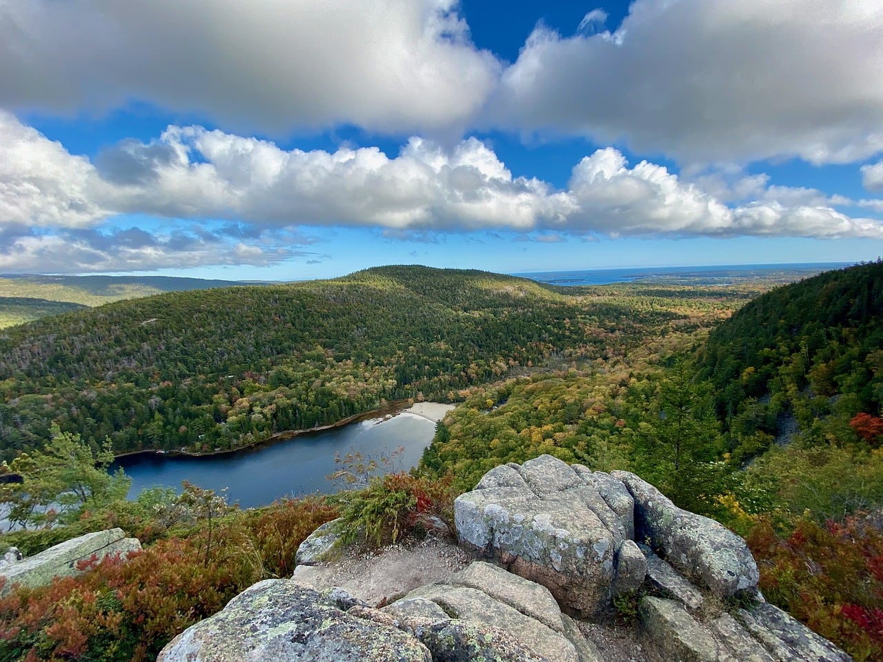
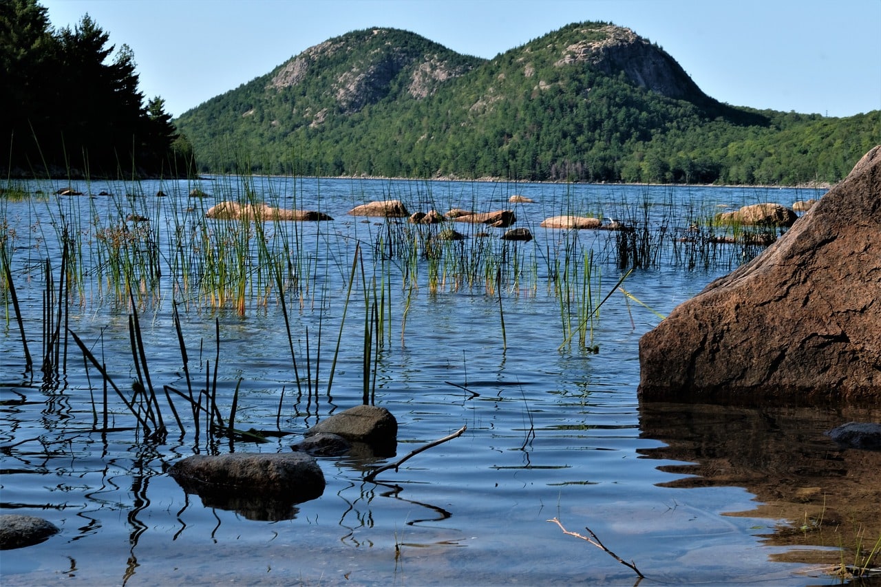
Acadia National Park is one of Maine's most attractive tourist destinations and one of the most visited natural areas in all of New England. The park is located south of the large city of Bangor, on the area of Mount Desert Island. The park boasts numerous spectacular trails, lakes, streams, a camping area, and more. True to New England’s charm, within the park are picturesque towns, the largest and most famous being Bar Harbor. This town is a sought-after tourist destination among the wealthy of New England and New York, who flock to their estates every summer. The city of Bangor to the north is the official gateway to the park and hosts a regional airport, many hotels and motels, and plenty of options for shopping and entertainment.
Click here for all the information on a trip to Acadia National Park…
How to Get to Acadia National Park in Maine?
Bangor International Airport (BGR) – A one hour and fifteen-minute drive from the park.
Portland International Jetport (PMW) is a three-hour drive from the park.
What is Acadia National Park?
- The national park spans the desert mountain island at the outlet of the Bay of Fundy
- The bay is the boundary between Nova Scotia and New Brunswick provinces in Canada, and its southern part forms the border of northern Maine and Canada
- Mount Desert Island is the largest of the islands off the coasts of Maine
- Around the national park are several resort towns, the largest of which is Bar Harbor to the east
- The gateway to Mount Desert Island is the large town of Ellsworth to the north. From here, the road descends south to the bridge crossing through the Thompson Island into Mount Desert Island.
- Acadia National Park is located a three-hour drive from Portland, Maine, and an hour south from Bangor
- You can also reach the park from Penobscot Bay, an hour and a half drive from Rockland
- The national park captures Maine's nature in its most concise manner – pine forests, islands, bays, expansive bodies of water, boats, and breathtakingly beautiful beaches. All in a cold and almost primeval atmosphere.
11. Grand Canyon
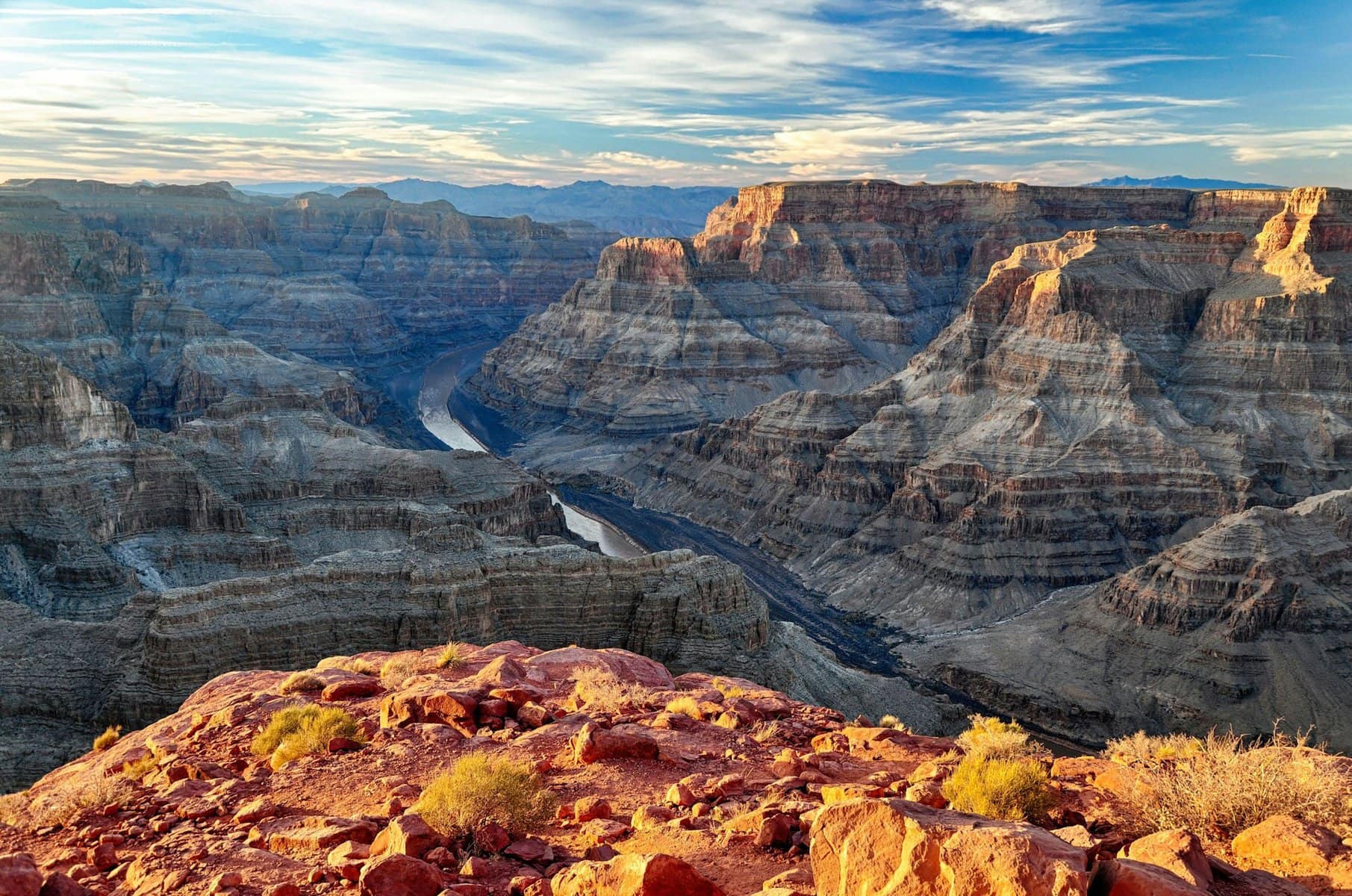
The Grand Canyon National Park is one of the most famous icons of America's stunning national parks. Located in the western part of Arizona, on a mountainous plateau of the Rocky Mountains at an elevation of 2,000 meters, the Colorado River carves into the soft desert rock, creating a chasm almost two kilometers deep above the surface. This vast chasm stretches nearly 450 kilometers, with its western part not far from Las Vegas.
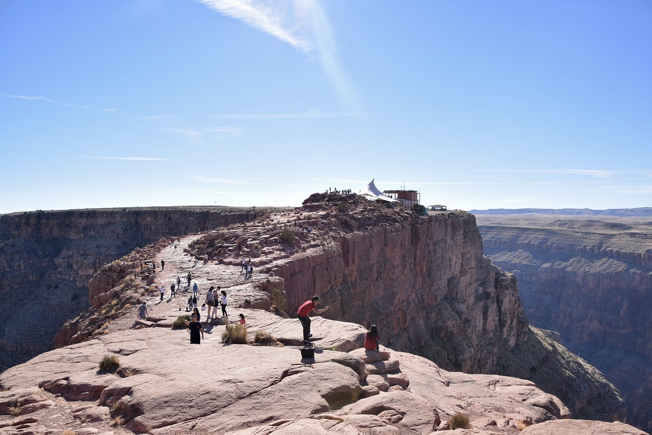
Grand Canyon Village is the main hub of the park, featuring trails, roads, and everything needed for stunning scenic views. Far from there, in the western rim, lies the breathtaking Skywalk attraction at Eagle Point, an observation deck with a transparent floor right above the canyon. The Skywalk is one of the most attractive day-trip destinations from Las Vegas.
Click here for all the information on visiting the Grand Canyon National Park…
How to get to Grand Canyon National Park in Arizona?
Phoenix Sky Harbor International Airport (PHX) – a three and a half hour drive from Grand Canyon Village, the logistical base of the national park.
Harry Reid International Airport (LAS) – The drive from the airport to the western part of the Grand Canyon takes about two hours. The driving time from Las Vegas to Grand Canyon Village is almost 6 hours.
How to explore the Grand Canyon?
The Grand Canyon trip is divided into two:
- South Rim, where the Grand Canyon Village is located – This is the official hiking area of the national park. It features cliffside hiking trails, a challenging trail down to the Colorado River, lodges, shops, organized scenic viewpoints, and picturesque roads
- Eagle Point in the West Rim – A small site with one stunning attraction – the Skywalk. This is the hiking area closest to Las Vegas and the most popular taste of the canyon for those who don't want to make the long drive to Grand Canyon Village
Click here for a list of 6 motels and lodges near the Grand Canyon…
The Grand Canyon National Park
The Great Canyon of the Colorado River, or the Grand Canyon, was declared a national park in 1919. The park covers an area of nearly 5000 square kilometers (a quarter of the size of New Jersey).
- The canyon stretches about 446 kilometers (longer than the distance from Metula to Eilat), its width is up to 18 kilometers, and its incredible depth is nearly 2000 meters
- There's a significant elevation difference of 300 meters between the two sides of the canyon, favoring the north side, which leads to climatic differences. The north side has an almost subtropical climate, including precipitation
- The southern rim of the canyon (South Rim), which is only a few kilometers from the northern one, is arid and desert-like
- The eastern part of the South Rim, north of the city of Williams, Arizona, is the most developed area in the park and the main tourist destination in the vast canyon
- The main accessible viewpoint of the enormous canyon is from the Grand Canyon Village and its surroundings, which is considered the visitor center of the South Rim
- The height of the upper rim is around 2000 meters, and the river's flow is about 760 meters above sea level. Since the flow is mountainous, the river's force still causes erosion in the soft rock, further deepening the canyon.
A secondary travel area is the Grand Canyon West, closer to Las Vegas, featuring the see-through Skywalk observation deck, which has become one of the most popular tourist attractions in the park.
Click here for a day trip from Las Vegas to the western part of the Grand Canyon…

12. Zion
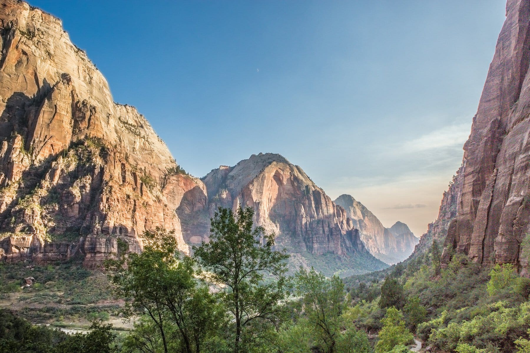
Zion National Park stretches along a stunning canyon of Navajo Sandstone, carved by the erosion of the Virgin River, a tributary of the Colorado River. The main canyon in the park is perhaps the most popular natural space among the vast variety of canyons and geological wonders of Southern Utah, where there is an impossible concentration of stunningly beautiful national parks. The canyon boasts legendary hiking trails, breathtaking views from the cliff's edge and the gorge, and an American order that allows even the most pampered traveler to experience the wildest nature.
Click here for all the information about a trip to Zion National Park…
How to get to Zion National Park in Utah?
Harry Reid International Airport in Las Vegas (LAS) – a little over a two-hour drive from the park.
How to tour Zion Park?
A significant part of the trip to Zion National Park takes place along the Virgin River route, a mountain river crossing Zion Canyon from north to south. The Zion Canyon Road climbs up the river to the Temple of Sinawava. Along the road, there are opportunities to head down to a wide range of attractions and hiking trails that ascend. North of the temple, there is the popular Riverside Walk trail. This is an accessible and easy trail, whose continuation, The Narrows, is a challenging trail involving climbing and walking along the creek itself.
Beyond the canyon, the park has several other attractions and hiking trails of various levels. The northern area of the Kolob Canyons is partially accessible by car. The town of Springdale, the southern gateway to the park, is the logistical center and the starting point for canyon trips.
What is Zion National Park?
Zion National Park is an enormous nature reserve that includes the spectacular Zion Canyon to the south and the pristine Kolob Canyons to the north. The central part of the park is Zion Canyon, formed by the erosion of soft rock by the mountain-fed Virgin River. The river carves its way from the Big Springs area high in the peaks and flows south-westward. It feeds into the Colorado River at the popular Lake Mead, slightly east of Las Vegas.
- The river carves its path through the soft sandy rock of Navajo Sandstone. This stone is the main geological feature of the Colorado Plateau region and the source of the stunning landscapes of the famous national parks of southern Utah and Arizona.
- The park is situated at the unique geological and climatic junction of the Great Basin (the high plateau bordered by the Sierra Nevada to the west and the Rockies), the Colorado Plateau (the upper drainage basin of the Colorado River), and the Mojave Desert, the massive rain shadow desert east of the Sierra Nevada.
- The length of Zion Canyon, the central site in the park, is about 24 kilometers and its depth is about 800 meters
- The elevation in the southern part of the park is over 1100 meters. Horse Ranch Mountain peak is the highest in the park, rising more than 2600 meters above sea level
- The elevation and topography have a profound effect on the park's extreme weather
Click here for a list of 8 lodge and motel options near Zion National Park…