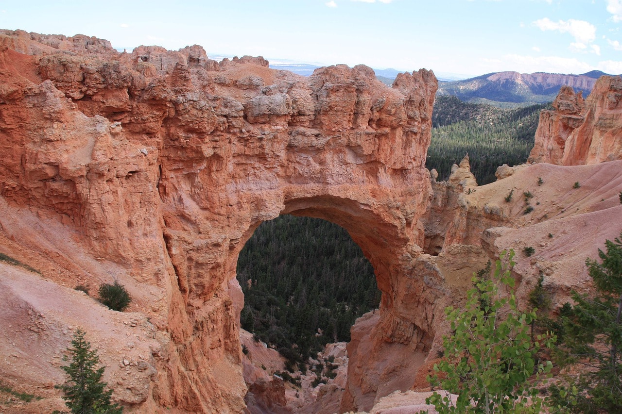
Bryce Canyon – The Unique Stone Hoodoos in Utah's National Park
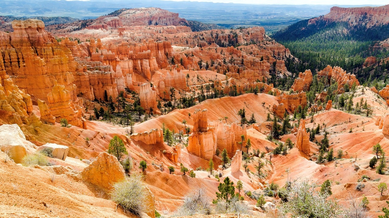
Bryce Canyon National Park, located in southern Utah, is one of the most unique geological spaces in the United States. In the wide canyons formed by the erosion of the soft sandstone, there are unique Hoodoo structures, which are the park's hallmark. These rock pillars, also known as Fairy Chimney or Earth Pyramids, fill the entire eastern escarpment of the amphitheater-shaped canyons. Above the abyss, the popular Rim Trail stretches between the park's viewpoints. Above the chasm, a long road connects the 13 viewpoint spots in the park.

How do you tour Bryce Canyon National Park?
Touring Bryce Canyon is relatively simple. The trip includes driving along Bryce Canyon Road (Route 63) from Bryce Canyon City in the north to Rainbow Point in the south. The road runs along the edge of the abyss, providing access to the 13 different viewpoints along the ridge above the chasm.
Among the viewpoints are connected hiking trails, the main one being Rim Trail (Edge of the Cliff Trail), which is considered easy with no steep inclines. From the cliff, several great hiking trails of varying difficulty levels (from moderate to hard) descend, reaching some of the canyon's unique landscape formations. A more immersive way to explore the trails down the canyon is by horseback riding.
How many days are needed for a trip to Bryce Canyon National Park?
For a basic visit to Bryce Canyon Park, you need to dedicate at least one day. For those who want to venture onto the lower hiking trails in the canyon, it's recommended to set aside at least two full days for the park.
Bryce Canyon City is a good base for lodging when visiting the national parks of Southern Utah and Northern Arizona.
Click here to check availability and prices at hotels near Bryce Canyon National Park…
8 Must-See and Do Things at Bryce Canyon National Park
- Walk easily along the Rim Trail
- View of the Hoodoos from Inspiration Point
- The fiery glow of the hoodoos at sunrise at Bryce Point
- Wall of Windows along the Peek-A-Boo Loop Trail
- View of the Sinking Ship and Boat Mesa from Sunrise Point
- Thor's Hammer along the Navajo Loop Trail
- Queen Victoria along the Queen's Garden Trail
- View of rocks in every color of the rainbow from Rainbow Point
Click here for a full day trip from Las Vegas to Bryce Canyon and Zion National Park + lunch…
What is Bryce Canyon National Park?
Bryce Canyon National Park is one of the most unique landscapes in the United States. It's the second most popular in the collection of timeless parks in the southern part of Utah, as the popular Zion National Park is located just an hour and a half drive to the west.
- The park is located on the western side of the Paunsaugunt Plateau, a geological section known as the Colorado Plateau
- The western edge of the plateau is characterized by sedimentary rocks and sand from different periods, built in layers and exposed by the formation of the canyon
- Bryce Canyon was formed by what is known as headwater erosion. This geological formation is created by the flow of mountain streams descending from the cliff's height. At the base of the cliffs, the lower aquifer waters dig and gnaw at the rock from which the waterfall descends, leading to the creation of a formation that resembles an amphitheater structure.
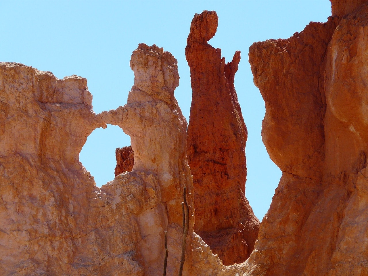
- The erosion of water and wind in the layers of sedimentary and sandstone created a unique sculpting of stunningly beautiful rock columns, throughout the half-circle of the amphitheater. These sculpted columns are called Hoodoo.
- The largest of the half-circles in the western rock line of the plateau is Bryce Amphitheater, which is almost 20 kilometers long and about 200 meters high.
- The amphitheater is named after Ebenezer Bryce, a Mormon settler who lived in the area.
- The amphitheater or Bryce Canyon and its surroundings were declared a national park in 1923 after several Mormon farms were built in its lower part.
Click here for a horseback riding tour in Bryce Canyon…
The base for your trip in Bryce Canyon is the town of Bryce Canyon City, which serves as the logistical and hotel hub of this remarkable natural area. The park is less popular than its neighbor, Zion Park, but some say that in terms of landscape formations, it is much more unique.
Map of Bryce Canyon National Park
How to get to Bryce Canyon National Park?
How to fly to Bryce Canyon National Park?
Harry Reid International Airport (LAS) in Las Vegas – The airport in Las Vegas is situated right next to the Strip and serves the tourist traffic of the gambling city. Formerly known as McCarran, it lies east of the Strip, just a five-minute drive from the Bellagio.
This is one of the busiest airports in the USA, connected to almost all airports in the USA and Canada, both small and regional. There are several routes arriving at the airport, including from major airports in Europe, making it easy to reach the airport via a transfer in Europe or East Asia. The travel time from the airport to Bryce Canyon National Park is about three and a half hours.
Click here to search for discounted flight tickets to Las Vegas or Salt Lake City…
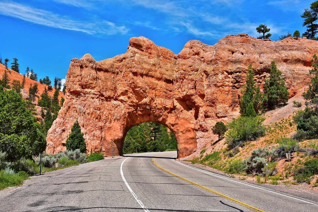
Salt Lake City International Airport (SLC) – The main airport of Salt Lake City, it is the largest in the state of Utah. It is one of Delta's main hubs, offering flights to several important European capitals such as London, Amsterdam, Paris, and more.
The airport is well connected with all major ports in the USA, including those on the Atlantic coast such as New York and Miami, as well as in the West. The travel time from Salt Lake City Airport to Bryce Canyon is almost a 4-hour drive.
How do you get to Bryce Canyon National Park by car?
Bryce Canyon is located in the central part of southern Utah, in a fairly remote and desolate area. Access to the park is from Bryce Canyon City, located on its northern side. The village/logistics center is situated on regional road number 63, a 2-minute drive south from regional road number 12 and twenty minutes from the main artery of Interstate 89.
The park is an hour-plus drive from the I-15 highway, which connects Las Vegas with Salt Lake City, and almost a two-hour drive from Interstate 70, which connects San Francisco with Washington D.C. through Salt Lake City.
For a guided tour of Bryce Canyon National Park with a local guide, click here…
When to Visit Bryce Canyon National Park?
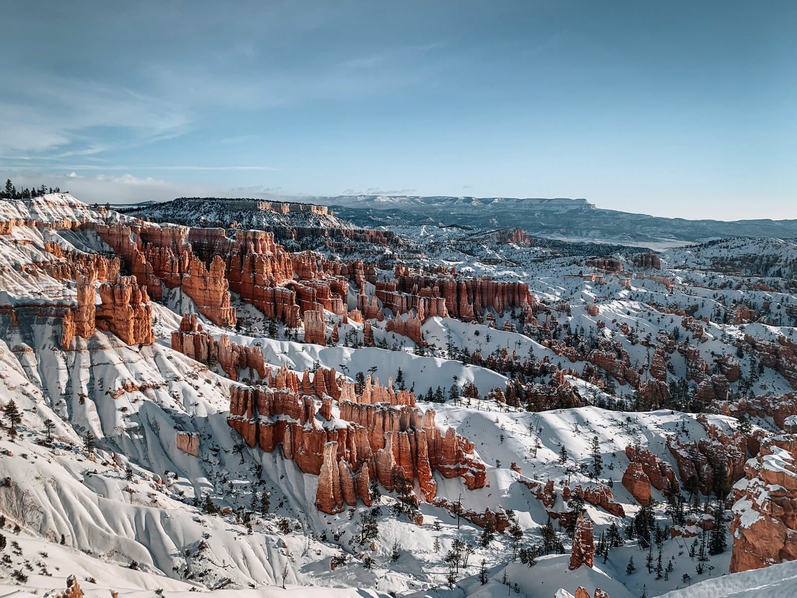
The weather in Bryce Canyon National Park greatly affects the trip conditions. It is a space with an extreme continental climate at a high altitude, higher than the neighboring Zion Park, with prominent desert and continental features. Precipitation in the area hardly affects the trip, as rain and snow are relatively rare. January and February have the most precipitation, and there can be significant snow accumulations.
For a day trip from Las Vegas to Bryce Canyon National Park, click here…
- The perfect season to visit Zion National Park is spring, from April to June. In spring, the weather is pleasantly mild. The area itself is green and enjoys streams from melting snow. The long daylight hours in June allow for extended hikes until the afternoon.
- Autumn is also an excellent season for a hike in Bryce Canyon. In October and November, the weather is moderate, no longer too hot and not yet freezing. Frost and snow begin in November, but even with evening temperatures around freezing, you can enjoy hiking in the area (it's likely to be sunny).
- Summer in Bryce Canyon National Park is tough. The weather is very hot and very dry, with average temperatures over 35 degrees Celsius. From mid-July to mid-September, there can be extremely hot days with temperatures over 40 degrees, on such days it's best to stay in an air-conditioned vehicle tour as access to park areas is limited.
- Winter in Bryce Canyon National Park can be harsh. Temperature fluctuations in winter are extreme, with chances for days of significant minus temperatures combined with occasional really pleasant sunny days with temperatures that can reach single digits. If you happen to experience a nice winter day, the park is a dream (as long as you're dressed well), but if it's freezing, exploring the park can be challenging, including accumulations of snow and ice.
How to plan a hiking route in Bryce Canyon National Park?
- The visit to Bryce Canyon National Park is part of the itinerary for exploring all the breathtaking national parks of southern Utah. The base for trips in the area is the city of Las Vegas, Nevada.
- The trip to the park is an integral part of an itinerary that also includes the neighboring Zion National Park to the west.
- On a long trip in the area, you can also explore the scenic roads of the Dixie National Forest, located between Zion Canyon and Bryce Canyon and the Grand Staircase-Escalante National Monument.
- If you have the time, it's worth heading east to the stunning parks of eastern Utah near the town of Moab – Arches National Park, Capitol Reef National Park, Canyonlands National Park, and the breathtaking Monument Valley on the Utah-Arizona border.
Click here to check availability and prices in Las Vegas hotels…
The journey through southern Utah is part of the most important national parks area in what is known as the Great Basin. Bryce Canyon National Park is located a one-hour drive east of Zion Park and a little over a three-hour drive from Las Vegas.
Click here for all the information about the hotels and resorts of the Las Vegas Strip…
- The circular route begins in Las Vegas, from there a drive to the spectacular Grand Canyon National Park in northern Arizona and then a nearly 4-hour drive to Bryce Canyon and Zion Park, before heading back to Las Vegas.
- A longer circular route (and definitely worth it!!!) includes a drive further east from the Grand Canyon to Monument Valley, then through the city of Moab, visiting the national parks in eastern Utah – Arches, Canyonlands, and Glen Canyon (Valley of Fire).
- You can also head north towards Salt Lake City and further north to the Rocky Mountain parks – Yellowstone Park and the neighboring Grand Teton Park. The drive to the northern parks takes two days each way, or a total of eight and a half hours driving.
Tour Route in Bryce Canyon Park
- The Bryce Canyon Road, highway number 63, is the main transportation route within the canyon area
- The road runs along the upper area of the amphitheater cliffs, spanning 30 kilometers south from Bryce Canyon City
- Along the road, there are 13 vantage points, each with nearby designated parking areas
- These viewpoints are also the starting points for the hiking trails in the park. The southernmost point on the road is Rainbow Point, and the northernmost is Fairyland Point.
- All 13 stop points offer breathtaking views of different sections of the canyon.
- It's worthwhile to visit all 13 viewpoints, but for time constraints, focus on a few top picks starting with Inspiration Point, Sunrise and Sunset Points, Bryce Point, and Rainbow Point.
Click here for planning a trip route in Bryce Canyon National Park and professional consultation…
All you need to know about accommodation in Bryce Canyon National Park
Accommodation in the Bryce Canyon area is roughly divided into two:
- Staying in the park's motels, those located in Bryce Canyon City
- Accommodation in the nearby town of Tropic, just a ten-minute drive from Bryce Canyon City
In Bryce Canyon City, there are several large motels serving as lodges, including two by Best Western. This is the most popular lodging spot in the park with very large lodge hotels. The city also has restaurants, but not much else to do beyond the park's operating hours.
Staying in Tropic is classic small-town American lodging. Along the main street of the town are a series of motels that are generally much more affordable than lodging in Bryce Canyon City. On Main Street, you'll also find shops, restaurants, and all the essentials for stocking up. But don't expect anything too lively.
Click here to check availability and prices at hotels in Bryce Canyon National Park…
All the attractions in Bryce Canyon National Park
Bryce Canyon National Park Visitor Center
The visitor center of the national park is a must-stop before truly diving into the depth of nature and the views. This small center is located just south of Bryce Canyon City and offers a very organized park experience. At the center, you can watch a short and highly informative film explaining everything you need to know about the park's structure and geological formations. It’s a family-friendly center, with memorabilia and facilities for kids to connect with nature and the essence of the park.
Rim Trail
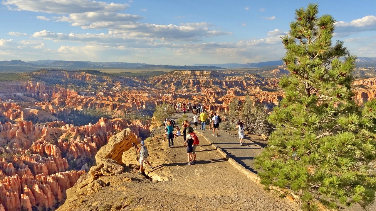
Rim Trail is essentially the heart of visiting Bryce Canyon. The trail technically begins at the northern part of the park at Fairyland Point and stretches a vast distance south to Bryce Point. The trail south from Fairyland Point is more for the advanced hikers. For the general public, it's recommended to start the trail at the busy parking lot of the Rim Trail Inspiration Point Trailhead. From this point, the Rim Trail ascends gently towards the viewpoints of Bryce Canyon, known as Inspiration Point.
The trail leads hikers right on the edge, above the descent towards the canyon's amphitheater structure. It offers stunning views of the Hoodoos, or the unique earth pyramids of the canyon. The full length of the trail for hiking is about nine kilometers, stretching to Bryce Point in the south. Most visitors to the park typically walk the segment between Lower Inspiration Point and Bryce Point.
For those who want, you can take the long journey that offers the most beautiful view ever, with a very gentle ascent and an extremely comfortable walking path. Or, you can use a car or shuttle to hop between the two stop points (Rim Trail Inspiration Point Trailhead and Bryce Point) and walk just a little along the path near the organized parking areas.
If you plan to take one chosen walk of several hours in the park, this trail is undoubtedly the main and most fundamental path of the entire park, and is a must, including a walk with the kids.
Click here for a horse-drawn carriage tour with a local guide on the Rim Trail…
Inspiration Point
Inspiration Point features the prime viewpoints over Bryce Canyon. The observation points are accessible via the Rim Trail and are located near the large parking area of the Rim Trail Inspiration Point Trailhead. The northern point, known as Lower Inspiration Point, is located right next to the parking lot and is very popular and crowded throughout the day.
A large portion of visitors to the park come to this easily accessible point by car. The Upper Inspiration Point is more impressive and is just a short walk south on the mountains trail. The view from the upper, southern point is much more striking and it's definitely worth taking the ten-minute walk on the trail to reach the upper point.
Bryce Point
Bryce Point is the southern viewpoint of the Rim Trail. It’s one of the most stunning viewpoints of the mesmerizing pyramid structures of Bryce Canyon, located in the southern part of the canyon. Bryce is considered the most beautiful spot in the park for watching the sunrise, particularly because of the sight of the first sun rays breaking on the pyramid structures, making them look as if they are on fire.
Bryce Point is the trailhead, the starting point, for two stunning yet challenging hiking trails. The Peek-a-Boo Loop Trail descends 9 kilometers deep into the canyon. A particularly long hiking trail that dives into the canyon is the Under-the-Rim Trail, which stretches over thirty kilometers. Anyone planning to venture on the long under-the-rim trail that requires an overnight stay needs to obtain a special permit from park authorities.
A short drive from Bryce Point is Paria View. From there, a short trail leads to a breathtaking viewpoint overlooking Yellow Creek to the south, a narrow, winding canyon adorned with stunning Indian cliffs.
The Peek-A-Boo Loop Trail
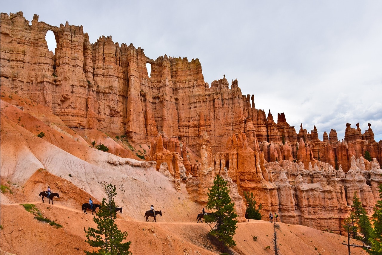
The Peek-a-Boo hiking trail is one of the most popular in Bryce Canyon Park. The trail is about nine kilometers long and descends from Bryce Point to one of the most beautiful parts of the canyon. Along the trail, you'll find the famous Wall of Windows, which resembles the wall of a medieval castle. The wall is composed of a massive sandstone base, and at the top, like fortifications, there are hoodoos and some arches creating the appearance of windows.
This is a trail with tough ups and downs, much loved by horseback riders. The loop trail is done clockwise, and there are signs indicating this. The trail connects at the bottom with the Navajo Loop Trail, which is also recommended. You can combine the two trails for a long hiking trip, though the Navajo Trail is best done with the Queen's Garden Trail slightly to the north.
Click here for a guided horseback ride down the canyon…
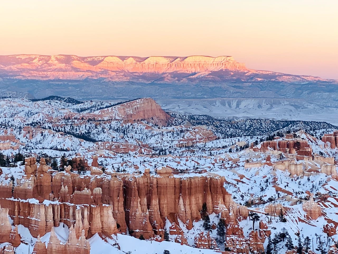
Sunrise Point and Sunset Point
The two adjacent points of sunrise and sunset are breathtaking viewpoints and an excellent base for hiking on trails descending into the abyss or the popular Rim Trail. They are located right next to the grand lodge in the heart of the park, The Lodge at Bryce Canyon, an ideal accommodation for the most serious hikers. This is the most developed area of the park south of Bryce Canyon City, including a convenience store. These two points are the base for trips to the park's famous trails that lead into the canyon, the Queen's Garden Trail and the Navajo Loop Trail.
Between Sunrise Point and Sunset Point runs the Rim Trail. Both viewpoints offer a stunning view of the more northern part of Bryce Canyon known as Fairyland Canyon. In Fairyland Canyon, you'll find the unique hoodoo formations of the Sinking Ship and what is called Boat Mesa. Sunrise Point is named for the breathtaking sight of the hoodoos at sunrise and the unique colors visible from this point toward the canyon.
The Navajo Loop Trail
One of the most popular hiking trails in Bryce Canyon Park is the Navajo Loop Trail. This trail consists of several paths descending from the Sunset Point Overlook into the stunning hoodoo formation known as Wall Street, named, of course, for the height of the unique pyramid columns in this part of the park.
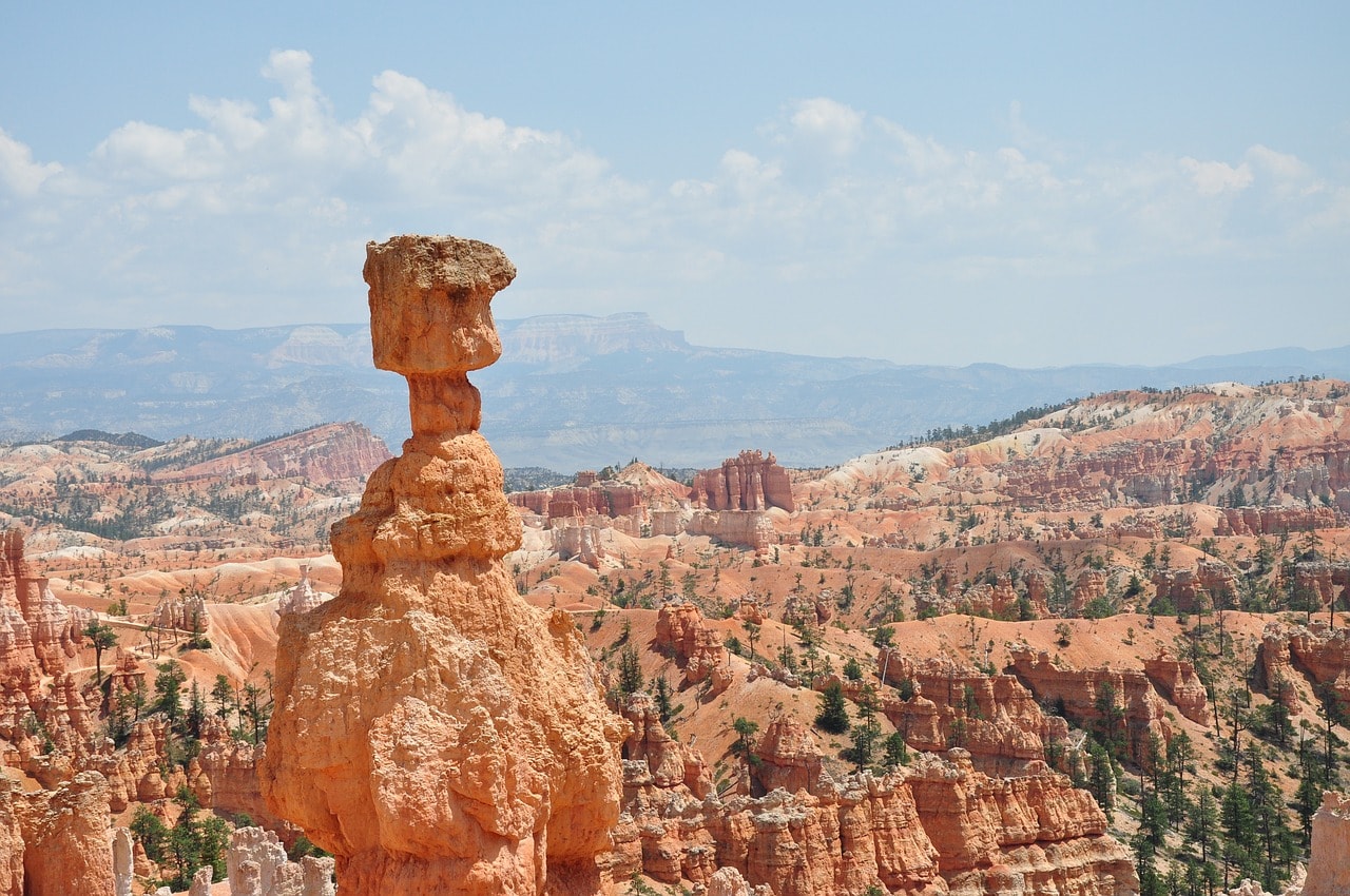
The trail also leads to one of the park's stars – the hoodoo known as Thor's Hammer. The trail is about two kilometers long and includes, naturally, a descent followed by an ascent that can be a bit challenging.
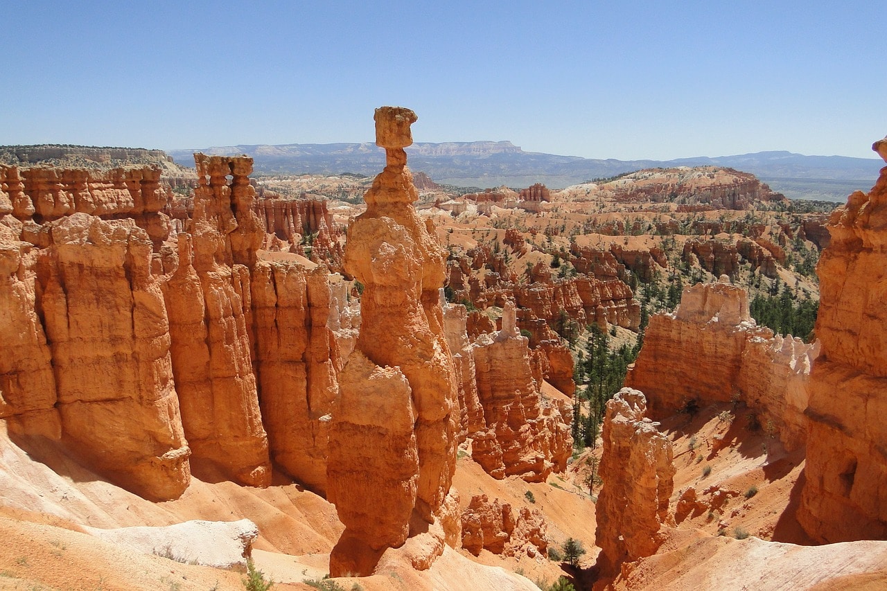
Queen's Garden Trail
The Queen's Garden Trail is a little over three kilometers long and descends dramatically from Sunrise Point deep into the canyon. The entire trail is named after the distinctive hoodoo referred to as Queen Victoria, as its appearance somewhat resembles a statue of a noblewoman.
The Queen's Garden Trail often combines with the Navajo Loop Trail, and it's worth doing both trails together as a slightly longer hike that really allows you to get up close to the unique hoodoo formations. It's a good idea to start the combined route by descending the Queen's Garden Trail and climb back up via the Navajo Loop.
Rainbow Point and Yovimpa Point
These two southern viewpoints of Bryce Canyon offer special and particularly beautiful scenic views of the southern canyon. Both points are accessible via Highway 63 and essentially mark the end of the road. Rainbow Point faces north towards the entire southern part of Bryce Canyon. The viewpoint is adjacent to the large parking lot at the end of Highway 63.
This is the best spot to see the various layers of colorful rock formations in the park, and due to the different colors, it got its name. The top part of the rim is known as the Pink Cliffs, below them are the Grey Cliffs. Looking towards the canyon, you can see additional layers of rock in different colors.
A bit to the south, Yovimpa Point offers a view from the north towards the amphitheater structure of Riggs Spring. This is a green valley bordered only by its edges with hoodoos. The valley features hiking trails loved by nature enthusiasts. Between Rainbow Point and Yovimpa Point, the Bristlecone Loop trail connects them, offering a wooded path of about two kilometers.