Road Trip on California's Central Coast – from San Francisco to L.A.
California Central Coast is one of the most famous and popular road trip destinations across the USA. The drive south from San Francisco on Highway 1 and Highway 101 offers access to some of the most beautiful landscapes on the Pacific Coast, spectacular resort towns, and unique places that are an integral part of California's Spanish history. Along the route, you'll find rich cities like Santa Barbara, Monterey, and Santa Cruz, beach resort towns like Carmel and Pismo Beach, and natural expanses where mountains touch the shoreline.

How many days do you need for a road trip from San Francisco to Los Angeles along the coastal highway?
The continuous drive on coastal roads from San Francisco to Los Angeles takes about seven hours. If you want, you can complete the drive in two days, but it's better to stretch the trip to three full days.
17 Must-See and Do Activities on a Road Trip from San Francisco to Los Angeles
- Urban tour in San Francisco
- Northern Elephant Seals at Año Nuevo State Park
- Surfing at Santa Cruz Beach
- Natural Bridges State Beach
- Strolling in Monterey
- The Beautiful Beach of Carmel
- The Stunning Views of Big Sur
- McWay Falls at Julia Pfeiffer Burns State Park
- The Astonishing Wealth of Hearst Castle
- The Giant Boulder at Morro Bay
- Mission Plaza in San Luis Obispo
- Vacationing at Pismo Beach
- La Purísima Mission and the Spectacular Blooms of Lompoc
- Urban Trek in Santa Barbara
- Amazing Marine Nature at Channel Islands National Park
- The Cliffs of Point Dume Beach
- Rich Urban Vibe in Malibu and Santa Monica
What is the California Coast Highway, Highway 101 / 1?
Highway 101, also known as the U.S. Highway 101 (or U.S. Route 101), is one of the most legendary (and touristic) roads in the USA.
- In its path through Southern California, the road follows the historic route of El Camino Real, the royal road that connected the 21 historic missions the Spanish built along California's coastline.
- The highway technically begins in downtown Los Angeles and ends in Olympia, the capital of Washington State, just south of Seattle.
- Along its route, the road often overlaps with Highway 1. When planning the route, it's worth driving close to the Pacific Ocean coastline, as there are segments where you should veer onto Highway 1, such as along the coast west of the Santa Monica Mountains and south of San Francisco.
- Highways 101 and 1 are California's older roads and became secondary with the completion of Interstate 5, which connects San Diego with Seattle and the outskirts of Vancouver, slightly to the east.
On the tour, we will refer to the route as Highway 101/1, but there are deviations from the highway aiming to travel the path with the most stunning views and access to interesting places along the way. The stretch of the tour is from the Golden Gate Bridge in San Francisco to Santa Monica in the south.
Map of the California Coastal Road Trip Route
How to Get to the Central Coast of California?
How to Fly to San Francisco?
San Francisco International Airport (SFO)
The main port of San Francisco is located on the bay shore about twenty kilometers south of the city's center. It is one of the largest and central airports on the Pacific coast in the USA and is easily accessible from anywhere in the world. This airport is one of the home hubs for United and Virgin America, making it accessible from every corner of the USA and Canada. It is also easily reachable via transfers from major airports in Europe. This airport serves as the base for trips in central California, including access to the Wine Country and Napa Valley to the north of the city and the magnificent Yosemite National Park.
The airport is located on Highway 101, right at the highway's entrance into San Francisco.
Click here for all the information on public transportation in San Francisco…
How to fly to Los Angeles?
Los Angeles International Airport (LAX) Los Angeles International Airport
The legendary Los Angeles airport is one of the largest and most important airports in all of North America. It's considered the second busiest airport in the USA (after Atlanta's airport) and the third busiest in the entire world. The LAX, as it's affectionately known in popular culture, is located near downtown Los Angeles, between Inglewood and Playa Del Rey Beach, right next to the 405 freeway.
When's the best time to take a road trip from San Francisco to Los Angeles?
The road trip route between San Francisco and Los Angeles on highways 101 and 1 can be done all year round. The weather in central and southern California is probably the most perfect weather in the world and mild from every possible angle. Of course, you need a bit of luck to avoid rain, but you can drive the road any day of the year.
- The best seasons to travel from San Francisco to Los Angeles along the coast are spring and summer. During these seasons, the weather is sunny and perfect (though it can be cloudy and rainy, so keep your fingers crossed). The beauty of the coastline is greatly enhanced by the shimmering rays of the sun on the ocean waters, so it's important to plan your trip for nice days at a micro level.
- The route is also beautiful in winter and fall. The weather can be cool, and even cold as you head north, but this shouldn't take away from the beauty of the scenery or the fun of the experience.
- In winter and fall, there's a greater chance of rainy days, so it’s well worth setting off on your journey when you know you've got some nice days ahead.
How to plan a road trip along the coastal highway from San Francisco to Los Angeles?
Planning the road trip along the coastal roads from San Francisco to Los Angeles is quite simple. The route follows the road south from San Francisco, always aiming to stay close to the ocean. It’s better to travel southbound from San Francisco (rather than north from Los Angeles), simply because the right lane is next to the ocean. The trip also includes the mega-cities San Francisco and Los Angeles, where it’s worth planning an urban tour in each city.
Santa Barbara and Monterey are the larger cities along the route, both with plenty of spots worth visiting. Besides that, the rest of the trip is just driving and stopping in small coastal towns or sites and attractions along the way.
Everything you need to know about lodging on a road trip from San Francisco to Los Angeles
The lodging at the start of the route is in San Francisco, and at the end of the route in Los Angeles or Santa Monica. Along the way, there are plenty of lodging options that are not urban in nature, except of course in Santa Barbara.
As befits a road trip in a developed area of the USA, there are many lodging options along the route besides motels. Along the way, there are small resort towns with experiential and unique hotels (with prices to match). In any case, every few kilometers, there’s an option to exit the highway to one of the motels along the way.
The recommended towns for lodging on the way between San Francisco and Los Angeles are:
- Monterey and Carmel
- Cambria and Morro Bay
- Pismo Beach
- Santa Barbara
In these towns, there are wonderful motels and beachfront hotels right on the water with adjacent parking. In the coastal towns, in Monterey and Santa Barbara, there are many dining and even evening entertainment options.
Map – Where to Stay on the Road Trip Route from San Francisco to Los Angeles?

San Francisco
San Francisco is the perfect liberal city of California. It blends progressive values with iconic sites like the Golden Gate Bridge and Fisherman's Wharf, offers crazy ocean and mountain scenery, stunning Victorian houses, excellent museums, quality shopping, amazing restaurants, and all the fun of America. San Francisco is one of America's most photogenic cities, with perfect weather and a high quality of life.
Click here for all the information on a trip to beautiful San Francisco…
Click here for selected walking tour routes in the districts of San Francisco…
Click here for all the information and tips on how to find a place to stay in San Francisco…
Click here for a list of 10 great hotels in San Francisco…
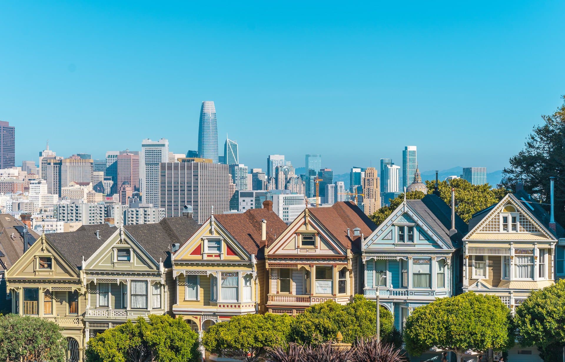
What is San Francisco?
- San Francisco is the largest and most important city in the center and north of the state of California
- The city is home to nearly one million people and its metropolitan area has about 7.5 million residents in what is known as the San Francisco Bay Area
- The metropolitan area includes the major cities of Oakland, with about half a million residents, and San Jose, which is even larger than San Francisco with over a million residents
- The corridor from San Francisco in the north to San Jose in the south, along the San Francisco Peninsula, is known as Silicon Valley, home to the headquarters of almost all the world's major tech companies.
All the information about San Francisco and tours in its various districts:
Click here for all the information on touring the downtown San Francisco sites…
Click here for the complete guide to visiting San Francisco's Chinatown…
Click here for all the info on the tour and the perfect spots for viewing the Golden Gate Bridge…
Click here for all the information on visiting Golden Gate Park sites…
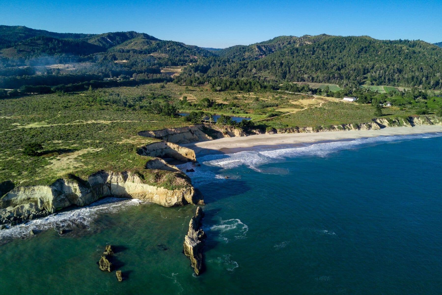
Año Nuevo State Park
Año Nuevo State Park is located about an hour's drive south of downtown San Francisco on Highway 1. This stretch of road, south of the Golden Gate Bridge, travels along the oceanfront through charming coastal towns like Montara, Miramar, Half Moon Bay, and more. These towns boast beautiful sandy beaches, bustling with bathers from all over the San Francisco metro area during the summer.
As you head south towards the area of Ano Nuevo, you start driving over bare hills offering a breathtaking view of the ocean. It's worth stopping at the small state park just to see the clusters of sea lions and northern elephant seals. The viewpoint above the coastline is accessible via a boardwalk and, besides the amphibious animals, offers a stunning view of the ocean shore.
For those who want a nature walk under the shade of sequoia trees, you can drive for an hour up to the mountains and reach Big Basin Redwoods State Park, one of California's oldest parks.
Santa Cruz
The small coastal city of Santa Cruz is just a half-hour drive south from Ano Nuevo Park. Home to only about sixty thousand people, it’s considered one of the most popular tourist destinations in California, largely thanks to its breathtaking coastline. The city is one of the most attractive surfing spots in the USA and is seen as a cornerstone of Californian surf culture.
On the city’s beach, known as the Santa Cruz Beach Boardwalk, all the fun of the young surfing world is there, including an amusement park, restaurants, and even the massive Santa Cruz Wharf, boasting plenty of great eateries. Another interesting site in the city is Mission Santa Cruz, established in 1791. The mission sits on a hill in the heart of the city above the San Lorenzo River. Today's mission is a replica of the city's historical mission.
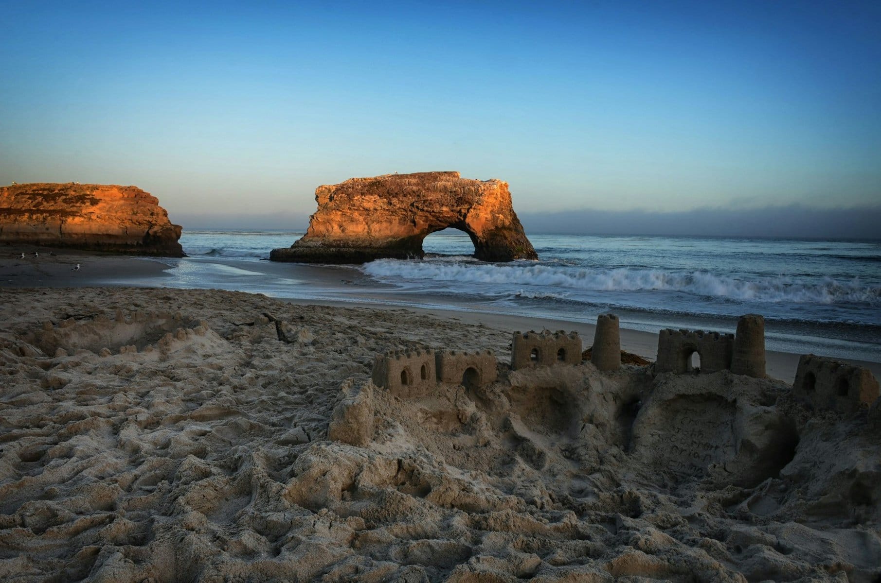
On the western outskirts of the city lies Natural Bridges State Beach, where there was once a small island connected to the shore by two magnificent natural arches. The arch that connected to the shore collapsed in 1980 and today only a small, charming island with a natural arch remains. It’s a popular beach for both swimming and nature watching.
Monterey
A 45-minute drive south of Santa Cruz on Highway 1, right by Monterey Bay, is the small city of Monterey. Despite its small size today, Monterey is one of the most important cities in California's history. Today, about thirty thousand people live in the city, but until 1848 it was the capital of California, before it moved to San Francisco and then to Sacramento under the federal union.
Exploring Monterey
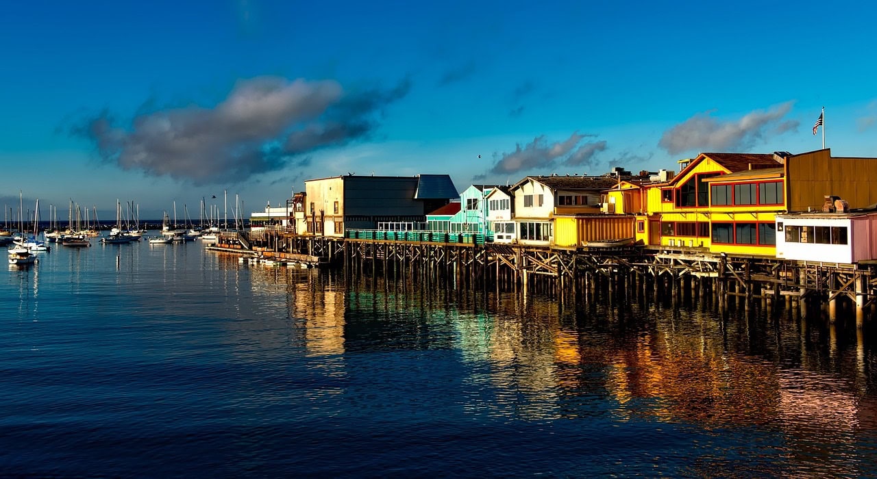
Today, Monterey is a charming tourist destination that combines historical sites, a vast coastline, and a thriving fishing port area. The heart of the city is Alvarado Street, home to restaurants, hotels, and more. This street is the center of the Monterey Jazz Festival, held annually in September (not to be confused with the Montreux Jazz Festival at Lake Geneva in Switzerland). The street leads to the Monterey State Historic Park, where you'll find restored historical homes, and to the Old Fisherman's Wharf, known for its excellent seafood restaurants.
North of the pier, beyond the hill of the Presidio, lies Cannery Row, an area filled with hotels, restaurants, and entertainment spots. In the past, the row's houses overlooking the ocean were fish canning factories. After World War II, the entire industrial area underwent a transformation and was turned into a very popular tourist space. At the northern end of the row is the Monterey Bay Aquarium. You can continue north to the bay's end where the luxurious resort town of Pacific Grove is located. On the hill above the mansions stands the Point Pinos Lighthouse, dating back to 1855.
Carmel
About a ten-minute drive south of Monterey is the luxurious resort town of Carmel. The town was mainly known for actor Clint Eastwood's tenure as mayor during the 1980s. Around three thousand residents live in grand estate homes adjacent to Carmel Beach, one of the most beautiful beaches in California.
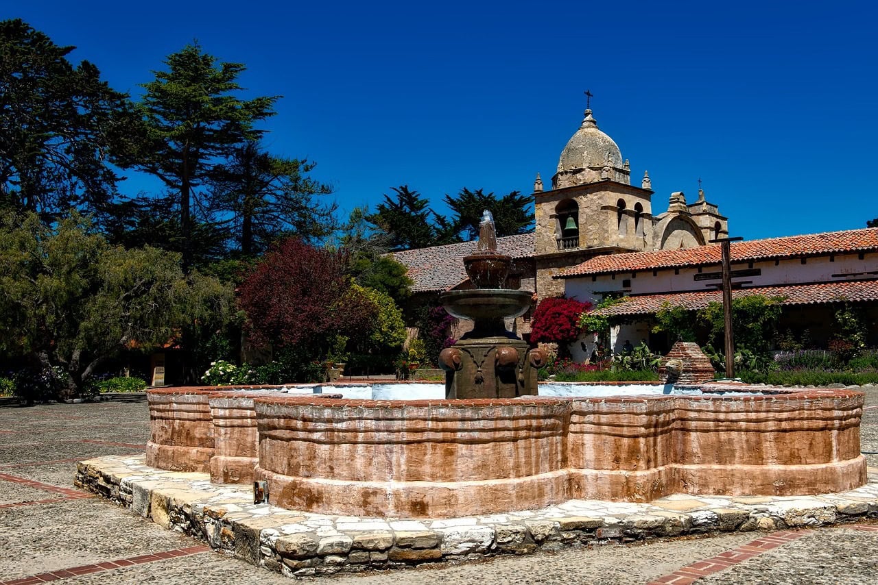
The heart of the town is Ocean Avenue, lined with luxury restaurants and charming shops. In the town's historic Roman section, you'll find the Mission San Carlos Borromeo de Carmelo, or simply Carmel Mission. Today, the mission has been restored and serves as a church and museum.
Big Sur
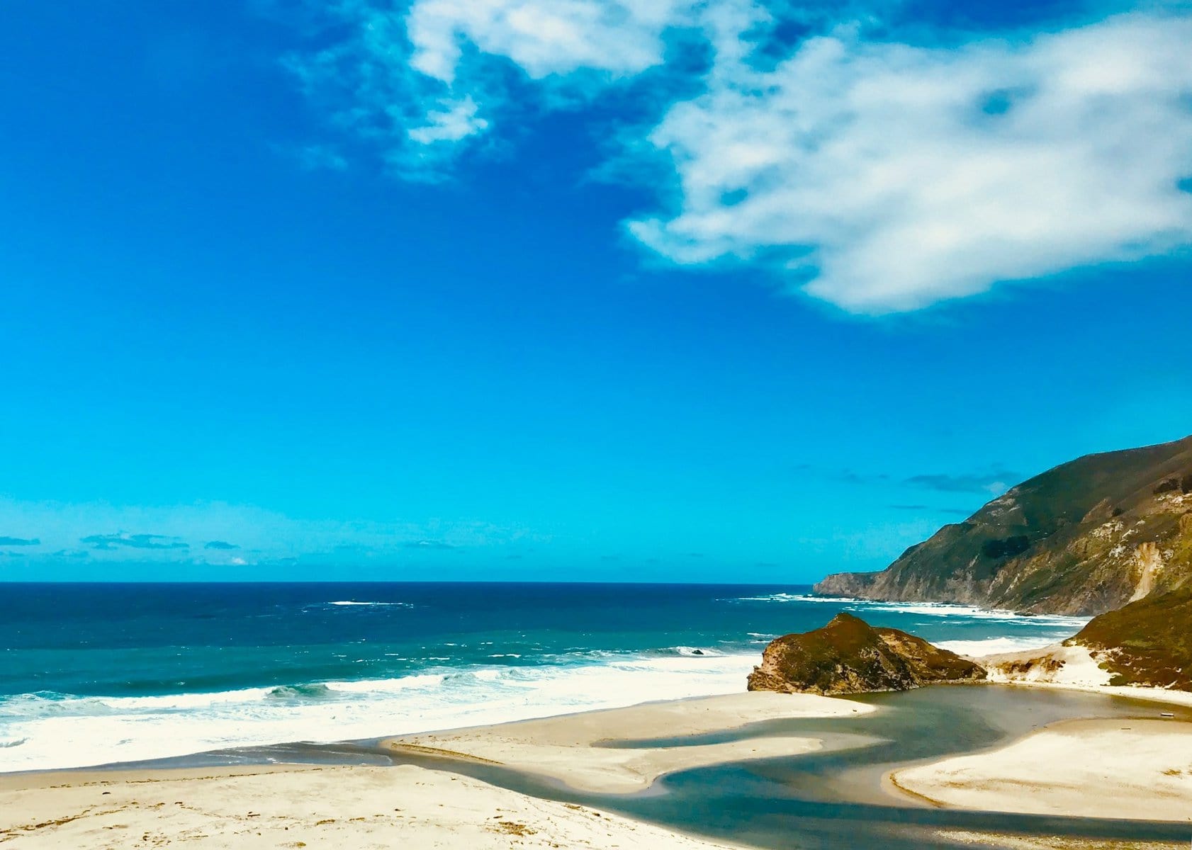
The coastline south of Carmel is called the Big South in Spanish. Big Sur is a region of mountains and nature, home to some of the most beautiful natural beaches in the Pacific Ocean (within North America). It's a place where the Santa Lucia Mountains crash dramatically into the sea. The coastline stretches almost a hundred miles south from Carmel to San Simeon, and Route 1 runs between the mountains and the shore, offering some of the most breathtaking views in California.
The drive in Big Sur begins from Carmel heading south towards the Point Lobos State Marine Reserve. Along the coastline, you can spot sea lions and seals, and see the unique Monterey cypress that can survive the ocean spray and salt, growing right at the coastline.
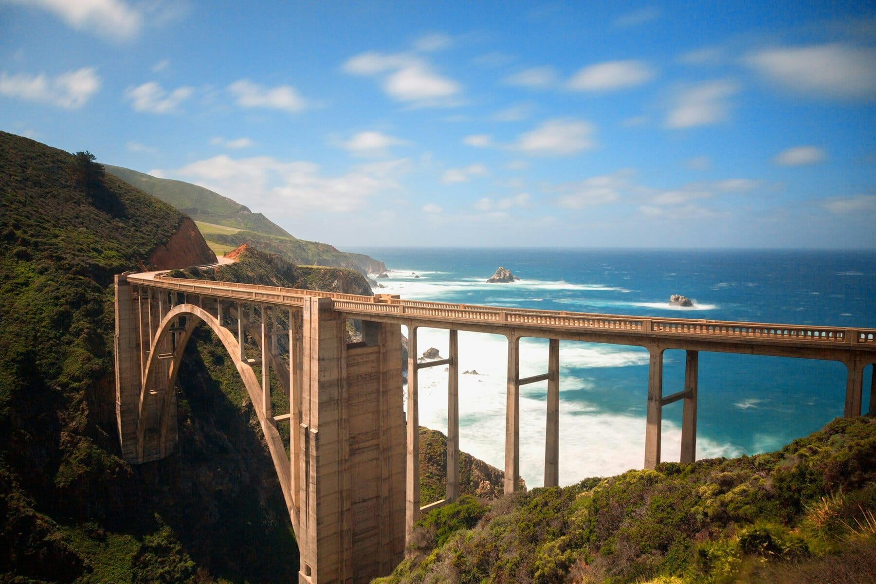
Just a twenty-minute drive south of Carmel, you cross the Bixby Creek Bridge, opened in 1932. The bridge spans 215 meters long and stands about eighty meters high. Once completed, it was the highest single-span bridge in the world.
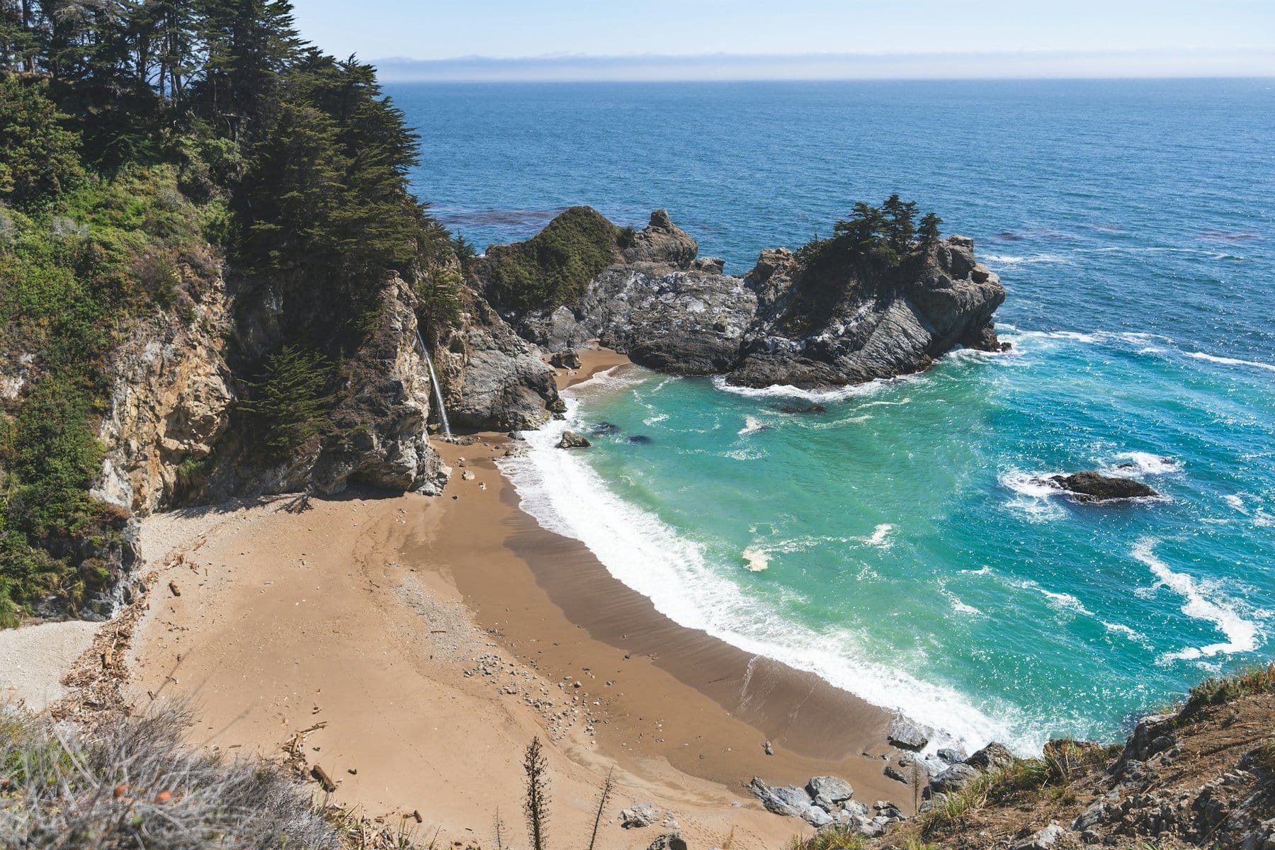
Further south, it's worth stopping at Andrew Molera State Park, where you can descend to the beautiful beaches. A bit further lies Julia Pfeiffer Burns State Park, home to the stunning McWay Falls, which cascades from the cliffs 30 meters down to the sandy beach. McWay Beach is one of the most unique beaches along the drive and a must-stop during your journey in Big Sur.
Hearst Castle
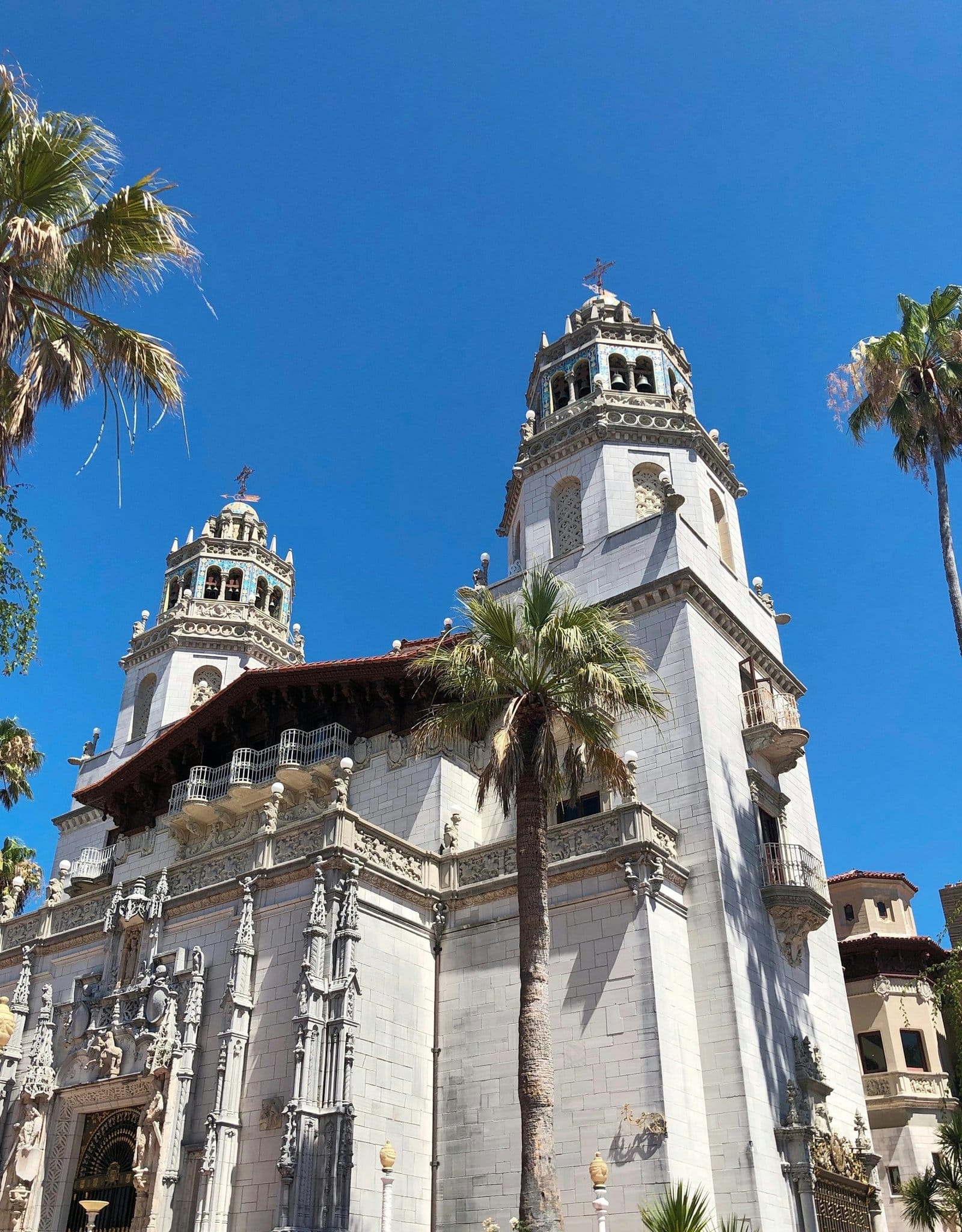
The stunning Hearst Castle stands above the village of San Simeon in the southern part of Big Sur. The castle was the private estate of newspaper tycoon William Randolph Hearst, where he lived with his family until 1947. The estate house and the surrounding gardens are now open to the public for guided tours and are considered one of the most popular attractions in California's Central Coast.
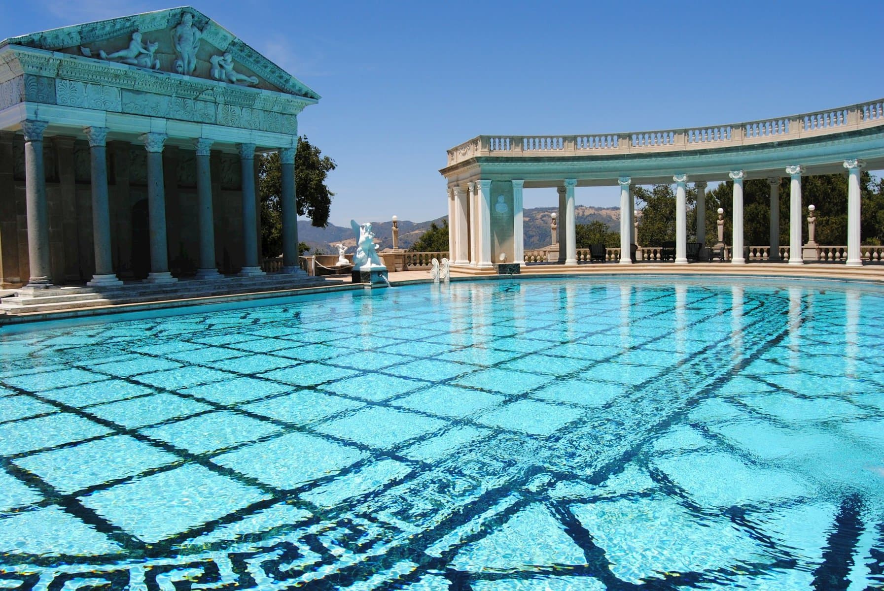
Entry to the estate is through the Casa Grande, featuring two huge bell towers. Inside the castle, there are numerous rooms and halls showcasing Hearst's unimaginable wealth. In the gardens, you'll also find the spectacular Neptune Pool named after the Roman sea god, surrounded by classic colonnades and what resembles a Greek temple with pediment sculptures.
Morro Bay
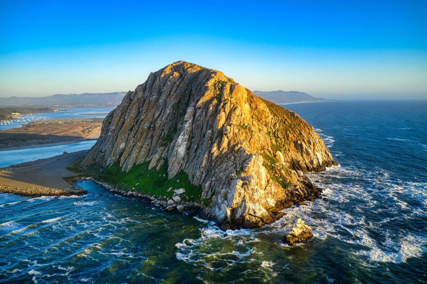
The picturesque fishing town of Morro Bay is located just a half-hour drive south of Hearst Castle. About ten thousand people live in the town, enjoying an abundance of water and beaches. In the southern part of the town lies a large lagoon, part of the Morro Bay State Park. Above the town, right on the coastline, stands the giant Morro Rock, an islet connected to the mainland with sand drift. Near the rock and the lagoon is the Morro Bay Maritime Museum.
San Luis Obispo
About a three-quarters of an hour drive south from San Simeon, you reach the city of San Luis Obispo. The city lies inland, in a valley formed between the Montaña de Oro mountain range on the coast and the San Lucia mountain range to the east. With a population of about fifty thousand people, it is generally considered the halfway point between San Francisco and Los Angeles.
The heart of the city is Mission Plaza, which stands next to the fifth mission built among the 21 missions of the Central Coast. The mission is situated near a green valley of a creek named after the city. The mission overlooks the plaza and creek and today functions as a church.
Pismo Beach
In San Luis Obispo, Highway 1 intersects with Highway 101 and they merge into the stretch of road that crosses the gentle hills of the De Oro Range. After a fifteen-minute drive through the range, you reach the ocean again, arriving at the coastal town of Pismo Beach. This is a classic resort town with a huge sandy beach along which there's a boardwalk and plenty of resort hotels. In Pismo Beach, the two highways split again, with Highway 1 running right along the coast as the main street of the town.
Lompoc
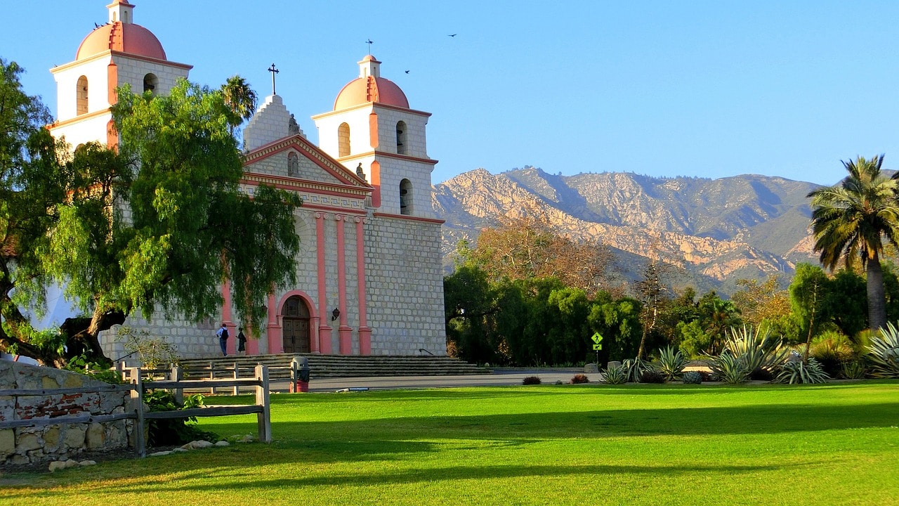
About fifty minutes' drive south of Pismo Beach lies the town of Lompoc. The town is nestled in the heart of an agricultural area known as one of the most fertile in the world for producing plantable flowers. In the spring, the entire valley around the town becomes a tourist destination for crowds coming to see the stunning blooms. On the outskirts of the town, you'll find the La Purísima Mission, a fully restored site that is now a state park. The mission is one of the most impressive attractions along the way.
Santa Barbara
Santa Barbara is the ultimate California dream. The city has everything you’d expect from California – sunshine, a stunning oceanfront, tall palm trees, historic sites from the Spanish colonial period, remnants of Native American culture, and above all, incredible wealth and breathtaking sunsets. The most Mediterranean city in California lies at the foot of the Santa Ynez Mountains to the east and hugs the golden shore of the Pacific Ocean. It's a bustling tourist city as part of the legendary route along Highway 101.
Click here for all the information on traveling in Santa Barbara…
What is Santa Barbara?
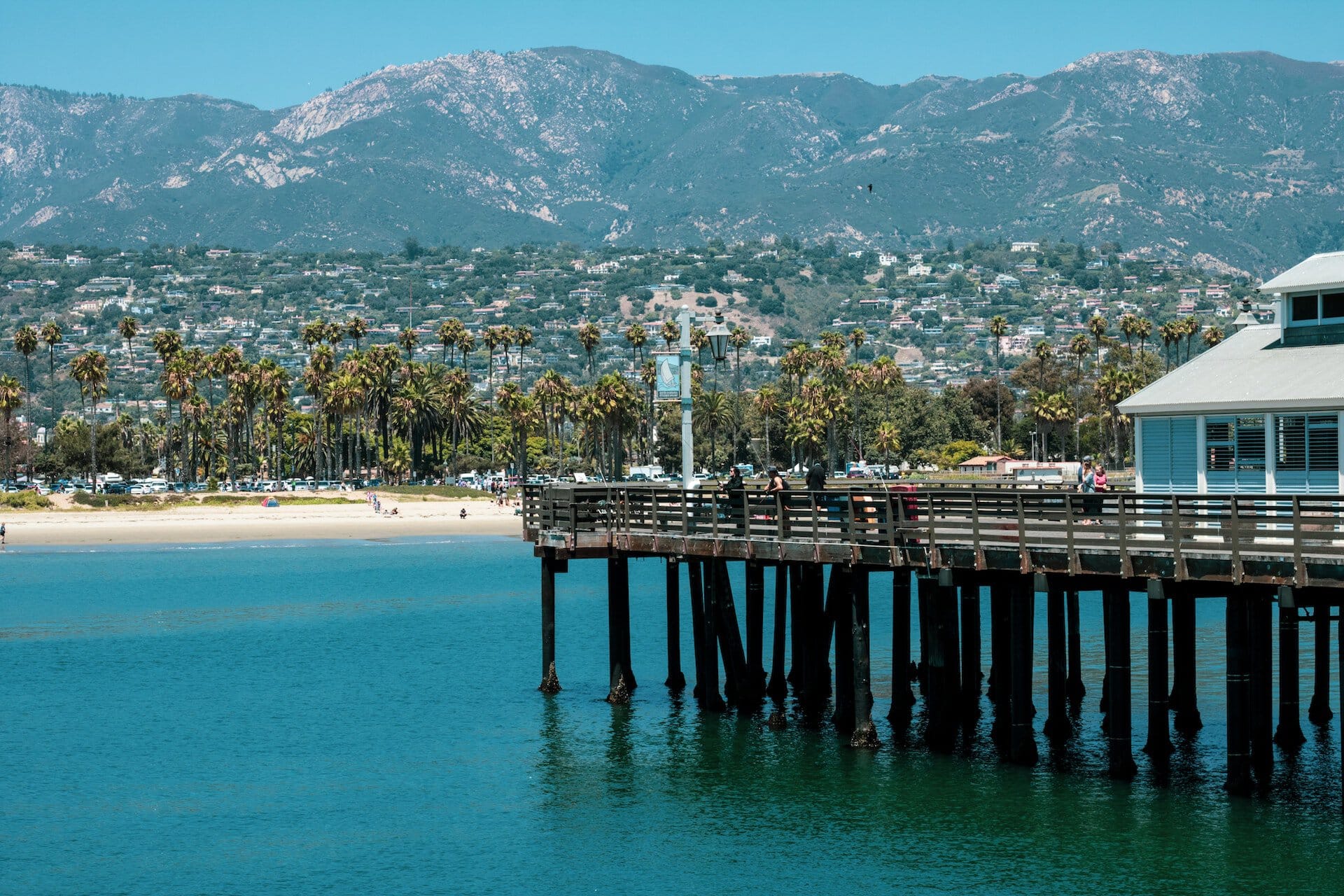
- The city of Santa Barbara is one of the most beautiful cities in California
- It lies at the foot of the Santa Ynez Mountains, which rise nearly 1500 meters high
- The city is nestled on the western slopes of the mountains along the Pacific Ocean, just an hour and forty-five-minute drive north from Los Angeles, along Highway 101 heading towards San Francisco (a 5-hour drive north)
- Santa Barbara is home to around one hundred thousand residents, with another one hundred thousand living in the small cities and towns nearby, known as the Santa Barbara metropolitan area
- This is one of the wealthiest cities in California, benefiting from perfect Mediterranean weather, low-rise buildings with large mansions, iconic palm boulevards, and all the beauty of California
Click here to check availability and prices at Santa Barbara hotels…
Like all settlements in California, the city's core was founded by Spaniards as a military base. It wasn't until 1850, when California joined the United States, that Santa Barbara became a city.
The city mainly developed after World War II, when many residents of Los Angeles were drawn to its spacious living and beautiful beaches, earning it the nickname the Riviera of California.
Channel Islands National Park
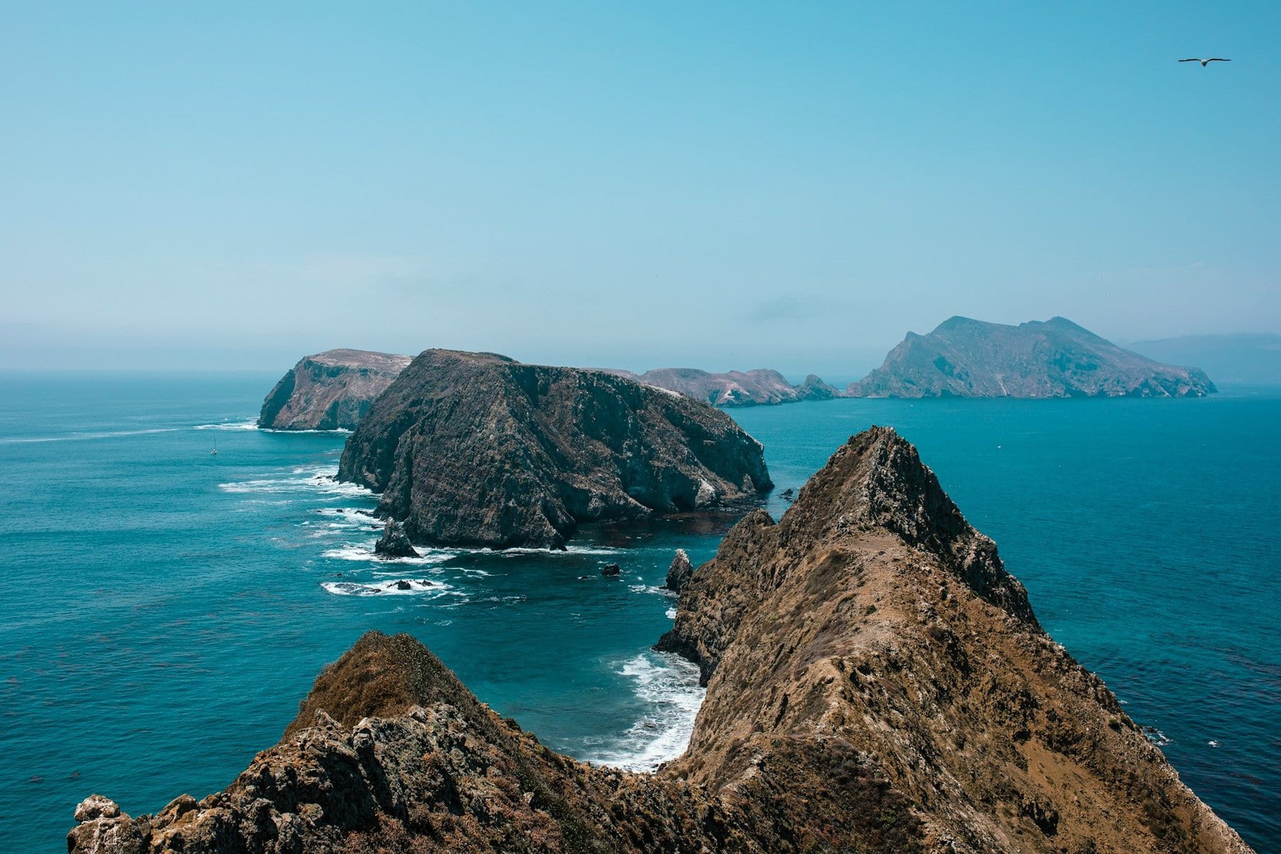
Channel Islands National Park is one of the most unique national parks in California and the entire USA. This park is made up entirely of islands that are isolated from the mainland, consisting of five islands south of Santa Barbara. It is accessible by ferries and boats from Oxnard or Santa Barbara, with a limited number of visitors allowed, requiring registration in advance.
The highlight of visiting the islands is during the summer when the weather allows for pleasant sailing, but many also explore the islands in the fall and spring for wildlife watching and following the whale migration. The main visitor center is located on Santa Cruz Island.
Point Dume Beaches
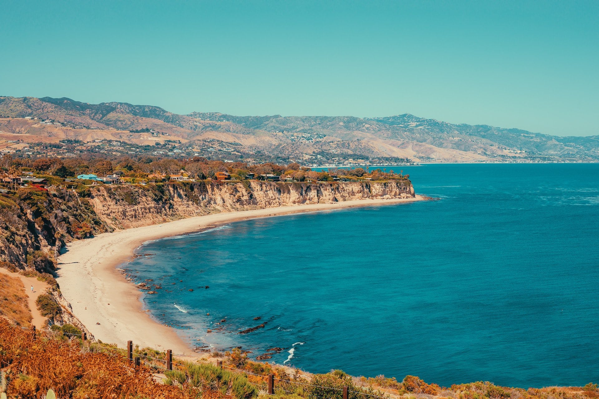
A one hour and fifteen minute drive from Santa Barbara or forty minutes from Oxnard, you'll find the stunning Point Dume beaches. Unlike the beaches of Malibu, the beaches west of what's known as Central Malibu, towards Point Dume, lie at the foot of high coastal cliffs. At the top of the cliffs are exclusive residential areas, but below are breathtakingly beautiful beaches. In the past, this area was known for its natural beaches, but today the whole area is developing residentially, though the cliffs still isolate the beach from the villas above.
Malibu
About a fifteen-minute drive from Point Dume is the upscale beach town of Malibu. Malibu is one of the most photographed and famous spots along California's coastline. The town has a population of just about ten thousand residents, on a place that's been quoted in popular culture over ten thousand times. Malibu is a quirky municipal entity stretching along a 43-kilometer coastline in the thin strip created by the slopes of the Santa Monica Mountains to the bay.
The width of this municipal entity doesn't exceed a few dozen meters. Behind the houses facing the bay runs the town's main street – Highway 1, offering the first taste of the legendary glam on the spectacular route for a road trip from Los Angeles to San Francisco.
Click here for a cool guided tour in Malibu with wine tasting…
Along the coastline, right next to the ocean's edge, you'll find the iconic homes of Malibu, each with a deck and stilts over the shore and water. This town is the residence of the wealthiest folks, movie stars, and anyone who wants and can afford a piece of L.A.'s glamour. It features in the 60s series Charlie's Angels, as the set for the TV show ‘Two and a Half Men', for ‘Hannah Montana', in the beach party scene from ‘The Big Lebowski', and as the place Samantha moved to after leaving New York in ‘Sex and the City', among many other series, movies, music videos, and more.
The coastline is privately owned by the homeowners, making it difficult to access, but you can stop by Malibu Colony Plaza, a small complex of restaurants and shops that acts as the town's hub. It's a very popular spot for celebrity-watching in the area.
Malibu Lagoon State Beach
Malibu Lagoon is the estuary of the seasonal mountain stream—the Malibu Creek, which now serves as the center of public life in Malibu. At the estuary, in what is called Malibu Point, you can swim in the waters of the bay before the beach was taken over by the wealthy homeowners. To the west of the lagoon stretches Malibu Colony Road, the most private and least accessible area of Malibu. The lagoon is also home to the historic Adamson House Museum. Nearby Highway 1 is a large shopping center with restaurants and stores.
Santa Monica
Santa Monica Bay is probably the quintessential place to visit and explore the concept of California. Along the long beaches of Venice and Santa Monica, the beach life of Los Angeles unfolds, with skateboards and rollerblades heading towards the iconic Santa Monica Mountains to the north.
Santa Monica is a fantastic place to hang out, with great restaurants and the famous pier over the Pacific Ocean. To the north, along Highway 1, lies the famous beach town of Malibu, with its houses spread out on the bay waters. Up in the hills, there are nature reserves with a Mediterranean character, offering stunning views of Los Angeles.

What is the Santa Monica Bay?
- The Santa Monica Bay is the body of water that borders Los Angeles to the west, with the Pacific Ocean waters
- The bay was formed by the folding of the Santa Monica Mountains, which enclose Los Angeles from the north and give the city's coastline its iconic look
- The bay stretches from Venice northward through Santa Monica to the southern slopes of the mountains touching the ocean waters
- On the slopes lies the famous seaside town of Malibu, followed by some of the most beautiful beaches in the metropolis such as Paradise Cove Beach and Point Dume Beaches, the western edge of the bay.
- Above Malibu, there are several popular nature sites offering a view of the bay to the south.
For a guided bike tour along Santa Monica Bay, click here…
The central city in Santa Monica Bay is Santa Monica, which is connected to Los Angeles and is part of the urban fabric of the city. The large coastal city is located west of Westwood and Beverly Hills and is a separate municipality from the big city.
- About 90,000 residents live in Santa Monica, in one of the most enjoyable and luxurious areas in the metropolis.
- Santa Monica is a very popular vacation city with plenty of hotels, restaurants, and entertainment venues.
- The main avenue of Santa Monica is Santa Monica Boulevard, part of Highway 2 that also forms the center of Beverly Hills and stretches westward to the ocean shore.
- The city's coastline is one of the most attractive leisure and vacation spots in Los Angeles, home to the famous Santa Monica Pier and the city's broad sandy beach.
Click here to check availability and prices for hotels in Santa Monica…
Topanga State Park
The large national park is located east of the village of Topanga, up the Santa Monica Mountains. It lies within the municipal area of Los Angeles, technically making it the largest nature reserve in the world located within a city. Access to the park is from the village of Topanga, a fifteen-minute drive from Highway 1 running along the coast.
The park has several hiking trails, but it's mainly popular with cyclists. The park offers scenic views towards Santa Monica Bay to the south and the San Fernando Valley to the north. In many parts, the park resembles the Galilee, with similar vegetation and a Mediterranean atmosphere. At the heart of the park is Eagle Rock, a large exposed rock that serves as a significant lookout point and landmark above the ridge's valleys.

Los Angeles
The city of Los Angeles, the City of Angels, has achieved an almost mythical status of glamour due to the film industry that settled there in the early 20th century. The city where the concept of Disneyland was born, first as a fantasy world and later as massive theme parks, is now a blend of almost spiritual New Age with a reality that can be a bit tough.
North of Downtown LA, at the foot of the Santa Monica Mountains range, lies a series of luxurious cities and neighborhoods such as Hollywood, Beverly Hills, Santa Monica, and more. Here you'll find glittering streets, celebrities, stunning beaches, and all the fantastic fun of Southern California.
Click here for all the information about traveling in Greater Los Angeles…

What is Los Angeles?
Los Angeles or L.A is the second largest city in the USA after New York and the largest urban center in the western USA. It is located in the southern part of California, along the Pacific Ocean.
- The city itself has around four million residents, and the giant metropolitan area around it boasts nearly 19 million people!!
- Los Angeles is one of the most important transportation, economic, and cultural centers in the entire world.
- The city is the absolute base of the television and film industry, home to the major production studios located in Hollywood. It is the global entertainment capital and probably the most mentioned and filmed place in popular culture.
Click here for a guided tour of celebrity homes…
Since the mid-16th century, the southern part of California was declared a territory under the Spanish flag.
Los Angeles was founded by Franciscan Spanish settlers in 1781 with the long name El Pueblo de Nuestra Señora Reina de los Ángeles de la Porciuncula. Our Lady of the Angels refers to the Church of Santa Maria degli Angeli on the outskirts of Assisi in Italy, the birthplace of Saint Francis.
Click here to search for a place to stay in Los Angeles hotels…
- In 1821, the Spanish recognized Mexico's independence and the city came under their control. During this period, it evolved from a small village into a large city after being declared the capital of the Alta California region.
- Like all of California, Los Angeles was conquered at the end of the Mexican-American War, which concluded in 1848, and since then it has become an integral part of the USA.
- After oil was discovered near the city, Los Angeles experienced an economic boom and grew into a large city. In the 1920s, it became a hub for the rapidly growing film industry.
- The city became very attractive due to its very pleasant Mediterranean climate and the glamour of the entertainment industry.
- The city expanded into the Santa Monica Mountains to the north and throughout the entirety of the San Fernando Valley, known as “The Valley”.
- Los Angeles was not built vertically due to its location on the San Andreas Fault, making it susceptible to earthquakes.
Click here for a guided tour of Los Angeles's most attractive sites…