Haight-Ashbury and Mission District – San Francisco's Hippest Neighborhoods
The Haight-Ashbury district is the birthplace of counterculture and the fun and detached world of hippies. In the late 1960s, it was the epicenter of Western culture. It stretches west of the Golden Gate Park. To the east of the district, below Buena Vista Park, lies the heart of the LGBTQ community, which is also strongly associated with San Francisco. The colorful Castro Street is the city's proudest street, just a bit west of the Mission District, where the Franciscan mission was the nucleus of the city's settlement.

How much time should you spend touring Haight Ashbury and Mission District?
For a tour of Haight-Ashbury, Mission District, and all the neighborhoods southwest of downtown, it's worth dedicating a few hours to half a day.
What are the must-see sights and activities in Haight Ashbury and Mission District?
- History at Mission San Francisco de Asis (Mission Dolores)
- Panoramic views from Twin Peaks
- The hippies of Haight-Ashbury
- The grunge of Lower Haight
- The vibrant atmosphere of Castro Street
- Jogging or a relaxing stroll in Panhandle Park
Click here for all the information on traveling in San Francisco…
Click here to check availability and prices for hotels in San Francisco…
Click here to rent a bike for a trip through the green parts of San Francisco…
What are Haight-Ashbury and the Mission District?
Haight-Ashbury and the Mission are southwestern residential neighborhoods of San Francisco, between Golden Gate Park and the SoMa and Downtown area. The Mission is the city's core settlement along with the Presidio. It's named after the mission established by Spanish Franciscan monks, in honor of Francis of Assisi. Around the mission, the city's initial core was constructed, which later expanded eastward. The central axis of Central San Francisco, what is today known as Market Street, connects the Mission with Downtown.
West of the Mission is the Castro neighborhood, intersected by Castro Street. The neighborhood and the street form the heart of the LGBTQ community that the city is so synonymous with.
San Francisco and the Hippies
Haight-Ashbury was a quiet residential neighborhood until the hippie movement made it their home by the late 1960s. Against the backdrop of opposition to the Vietnam War, the discovery of new drugs, alongside the explosion of rock and pop culture, the Summer Of Love was a massive event that took place in Golden Gate Park and included the gathering of flower children from all over the U.S. across the park.
The summer featured lots of psychedelic drugs, marijuana for breakfast, music, long hair, free love, and the refinement of hippie ideology. The movement spilled over from the park into the nearby Haight-Ashbury neighborhood, where it settled for the years to come. By the early seventies, both the district and the movement as a whole faded, becoming a pretty scary place.
- The hippie ideology fit San Francisco like a glove, and to this day, the city remains a hub for nostalgia rooted in the movement's culture.
- Beyond that, the city residents are considered very liberal and closely linked to the permissive movement and the philosophy it tried to implement.
- To this day, the neighborhoods enjoy the nostalgia of the unique movement, which also includes quite a bit of tourism trying to discover its magic from seventy years ago.
West San Francisco Today
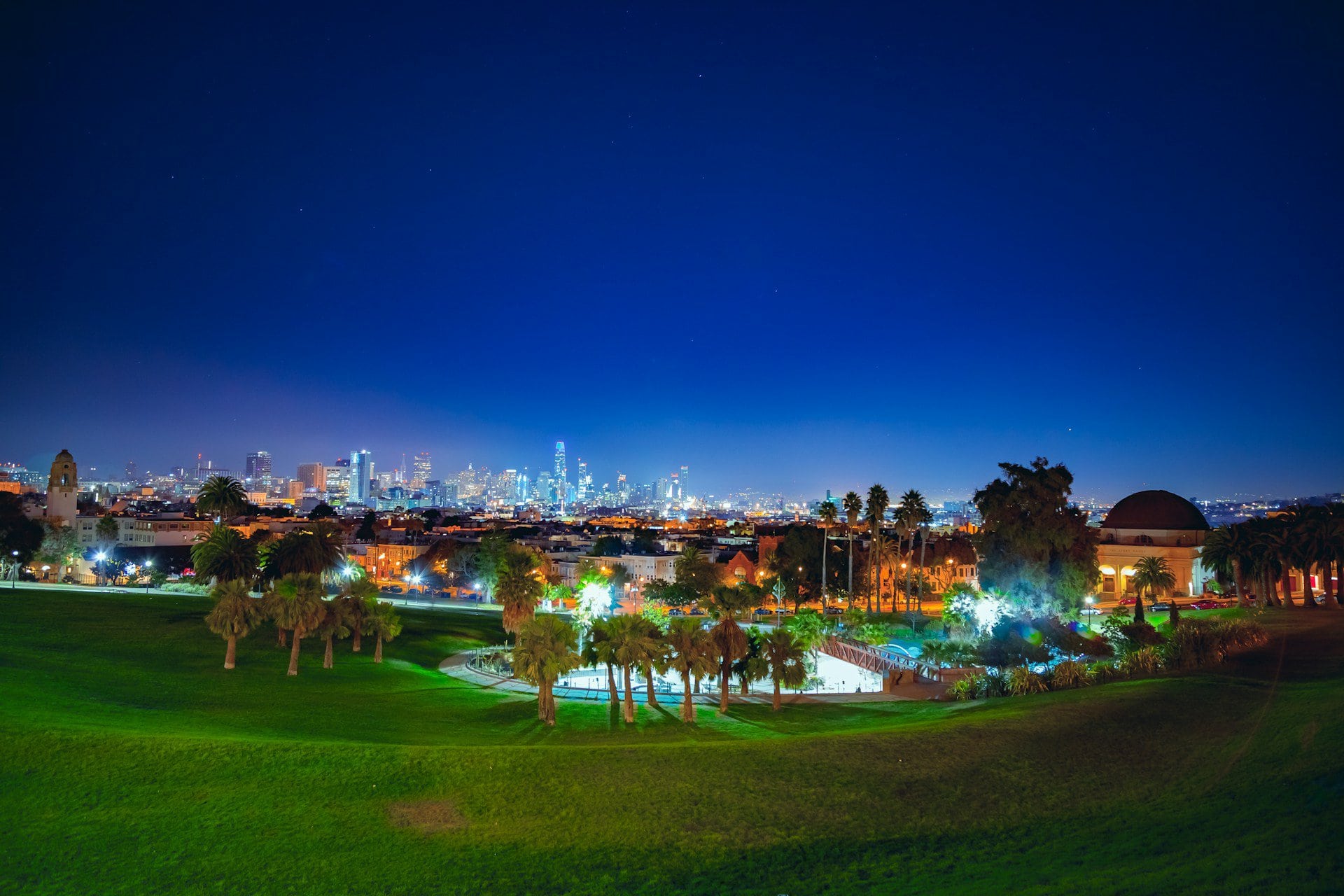
Today, the whole residential area enclosed by Golden Gate Park to the west, Twin Peaks to the south, and the city's central districts to the west blends an atmosphere that is sometimes gray and calm and at times especially vibrant.
This is an eccentric area in many different ways, including geographically, with hills, descents, and ascents and of course, streets with stairs, as well as some unpleasant areas and places at the edge of human experience (strongly influenced by psychedelic drugs). It is a very liberal area, on the line between absolute freedom and neglect.
The neighborhoods haven't fully gone through gentrification yet (but it might happen), and they still have some of the magic from the 1960s.
Map of Haight Ashbury and Mission District
Everything to See and Do in Haight Ashbury and Mission District
The Intersection of Haight and Ashbury Streets
The most mythological intersection in San Francisco is where Haight and Ashbury Streets meet, a spot that inspired the name of the whole district. It's the epicenter of the major cultural quake (the second in the 20th century of San Francisco) for the counterculture that transformed Western culture in the 1960s. The district was home to thousands of young people who flocked to San Francisco for the Summer of Love in Golden Gate Park, and since then it has been considered the heart of the movement.
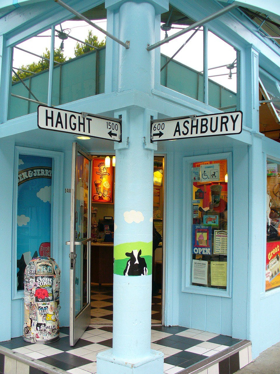
The main street in the neighborhood is Haight Street, which connects Golden Gate Park with Buena Vista Park. Along it, you'll find all the glitz and glam of the sixties, complete with liberal-side cafes and restaurants, plenty of psychedelic colors and graffiti, vintage and second-handed stores, and everything that harks back to the mythical counterculture movement.
The house where members of the Grateful Dead lived, at 710 Ashbury Street, has become a mini attraction in the neighborhood.
The Panhandle Park
The Panhandle of Golden Gate Park is the eastern section of the large urban park that lies to the west of the Haight-Ashbury neighborhood.
The Panhandle is part of the park's original design; it's about eight blocks long east of the rectangular park and one block wide. These proportions make the Panhandle more of a wide boulevard than a park, but it's still a green and peaceful spot beloved by residents of the nearby neighborhoods.
The Handle separates the Haight-Ashbury District to the south from the University of San Francisco campus to the north. After the hippies were cleared from the Golden Gate Park in the Summer of Love, the Handle continued the tradition as the chill-out spot for the hippies who then resided anywhere possible in Haight-Ashbury.
Lower Heights
The Lower Heights neighborhood is one of the more unique spots in contemporary San Francisco, for better or for worse. It's strategically located south of the tourist attraction of the Painted Ladies at Alamo Square, west of Civic Center Plaza and Hayes Valley, and east of the Panhandle and Haight-Ashbury. To the north, the neighborhood is also influenced by the African-American vibe of the Fillmore District.
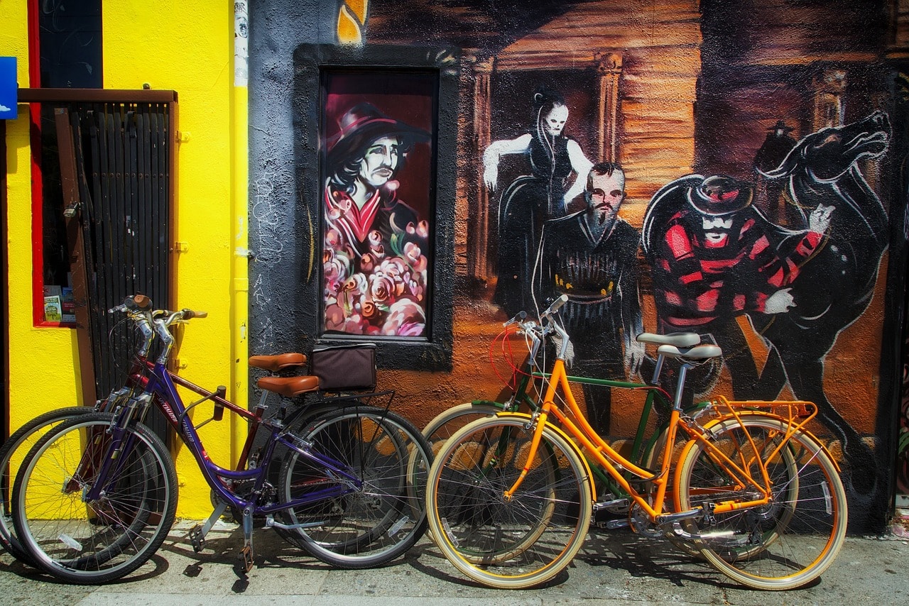
The neighborhood may not be the safest place, but it's very young and lively. It's heavily influenced by grunge culture and is home to unique shops and groundbreaking restaurants. The general feeling is that it's on the brink of gentrification, and soon all its rebellious charm will be framed as a tourist attraction.
Buena Vista Park
Buena Vista Park is located atop a hill on the eastern side of the Haight-Ashbury district. Accessing the park from the west is gentle, but the hill becomes quite steep towards the east, sloping down towards Market Street and the Mission District. At the hilltop, there are wooded trails and a sense of escape from the city.
South of the park is the residential Buena Vista neighborhood. This hilltop neighborhood connects with the Castro district to the east via the charming Vulcan Stairway attraction. It's worth descending the stairs for a beautiful view of the Mission district below. Along the way, you'll find green gardens of homes and a particularly pleasant tranquility. Down the steps is the Randall Museum, a science museum for kids, which is loved by the local education system for its educational programs.
GLBT Historical Society Museum
This is one of the most important museums of another result of counterculture, the struggle for equality of the LGBTQ community. San Francisco is perhaps the city most identified with the LGBTQ community, due to both its historical counterculture connections and its perennially hyper-liberal nature.
The museum is located on Castro Street, the vibrant heart of the Castro neighborhood, in a small and characteristically neighborhood-style building identified only by a large pride flag. It's not an ostentatious or grandiose museum, but one that approaches the gay liberation movement in a historical and almost academic manner. The museum features exhibits and historical artifacts related to the community's liberation movement.
At the intersection of Castro Street and 18th Street, the museum's street, the crosswalks are painted in rainbow colors, known as the Rainbow Honor Walk. From there, the fashion spread to other cities in the West. The Castro district and Castro Street are traditionally considered the heart of the city's LGBT community and one of the most iconic sites associated with the community worldwide.
Address: 4127 18th St., San Francisco
Click here for the museum's current visiting hours…
Mission San Francisco de Asis
The Mission of San Francisco, also known as Mission Dolores, is the original settlement core of San Francisco. The mission was established by Spanish Franciscan monks in 1776 in the heart of today’s Mission District, which is named after it. Next to the old mission building, the large Mission Dolores Basilica was built in 1918. Near the old mission building lies the city's first cemetery, where the Spanish founders of the city are buried.
Address: 3321 16th St., San Francisco

Dolores Park
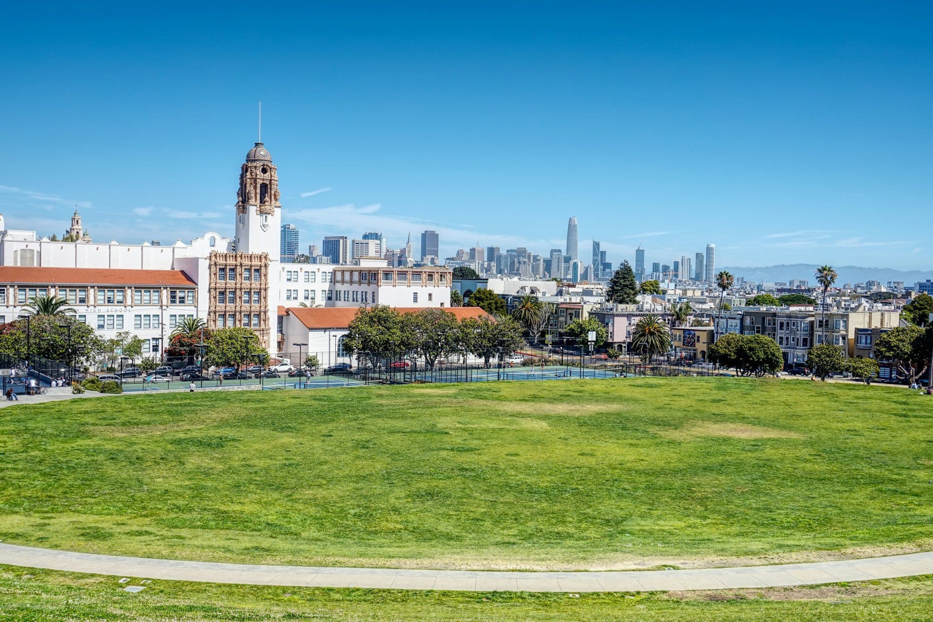
The charming Dolores Park is located two blocks south of the mission, in the heart of the Mission District. It's a pleasant urban park, and like all of the city's urban parks, it is situated on a hilltop. At the eastern entrance to the park is the Mexico Liberty Bell. Up the hill, lawns and scattered trees are full of people sunbathing or picnicking on sunny days. The park offers a lovely view towards downtown.
Twin Peaks
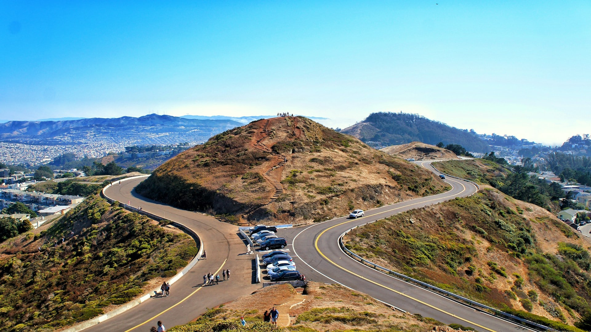
Twin Peaks are two relatively tall hills, reaching heights of about 300 meters. These hills mark the southeastern boundary of downtown San Francisco and are the starting point of the central axis of the city center, Market Street, which descends from the hills and cuts its way to the San Francisco Bay. The hills are green parks with plenty of nature trails for walking. Twin Peaks are the best spot for a panoramic view of the entire center of San Francisco.
Planning a Travel Route in West San Francisco – The Presidio, Golden Gate Park, and the Mission
Travel Route in Golden Gate Park, Haight-Ashbury, and the Mission District
The city's largest urban park – Golden Gate Park, was the scene of the Summer of Love in 1967 and is the western twin of New York's Central Park.
- It's a good idea to start your tour in the park's western part by the ocean where the Queen Wilhelmina Garden is located. In the center of the garden, there's a Dutch windmill surrounded by flowers typical of the Netherlands.
- Nearby was the fenced pasture area for the buffalo – the Bison Paddock.
- In the heart of the park, you'll find the artificial Stow Lake with beautiful Strawberry Hill Island at its center.
- A bit east of the lake is the complex of the de Young Museum, the California Academy of Sciences, San Francisco’s grand Botanical Garden, the Japanese Tea Garden, and the Shakespeare Garden.
- To the east, in the northern part of the park, you’ll find the Conservatory, a large greenhouse structure dedicated to preserving plants and flowers.
- North of the park, in the Little Russia neighborhood, stands the magnificent structure of the Holy Virgin Orthodox Church.
The southwestern districts of San Francisco – Haight-Ashbury and Mission, are located at the southwestern corner of the park. Haight-Ashbury was the residential area of the hippies who flocked to the city in 1967. To this day, counterculture dominates the district, turning it into an attraction in its own right.
- The northern part of Haight-Ashbury is marked by the long boulevard of the ‘panhandle,' the thin extension of the Golden Gate Park towards the east.
- Two blocks south of the Panhandle stretches attractive Haight Street, filled with second-hand and vintage shops.
- At the eastern end of the street, near the house where the band Grateful Dead operated, lies the charming Buena Vista Park.
- From the park, you can head down towards the Castro neighborhood via The Vulcan Steps.
- Castro Street is considered the center of the LGBTQ+ community that is so closely identified with the city. The LGBTQ+ museum is also located there.
- To the east lies the Mission District, the city's settlement core, with the Franciscan Mission established in 1776 at its heart.
- Near the mission, you'll find Dolores Park, offering a stunning view of the city
- West of Castro and the Mission District, you can drive to Twin Peaks for a spectacular viewpoint
A Walking Tour in Presidio and Lands End
The best way to explore the neighborhoods and open spaces known as Western San Francisco is to start from the north and head south. The city's most iconic landmark, the Golden Gate Bridge, marks the northern tip of the peninsula, now home to the Presidio Park.
- Fort Point, a preserved fortress built by the Spaniards as part of the Presidio's military array, is nestled right beneath the southern end of the Golden Gate Bridge
- Climb the fort's wall for a scenic view and then stroll along Marina Drive to Crissy Field, the landing strip of the American military base right on the coast
- Nearby is the Walt Disney Family Museum, alongside the Letterman Digital Arts Center, created by George Lucas
- It's also worth visiting the western batteries of the Presidio, from where you can descend to Marshall Beach, offering a breathtaking view (also from the batteries) towards the Golden Gate Bridge.
- South of the Presidio is Land's End Park, overlooking the Pacific Ocean. Here you'll find the Legion of Honor Museum, the finest art museum in San Francisco.